
REAL DOSSIER EVIDENCE
Landscape constraint: the mapped feature reaches 2 m from the boundary
Does the regional reading show that the landscape designation touches the parcel?
Dossier result
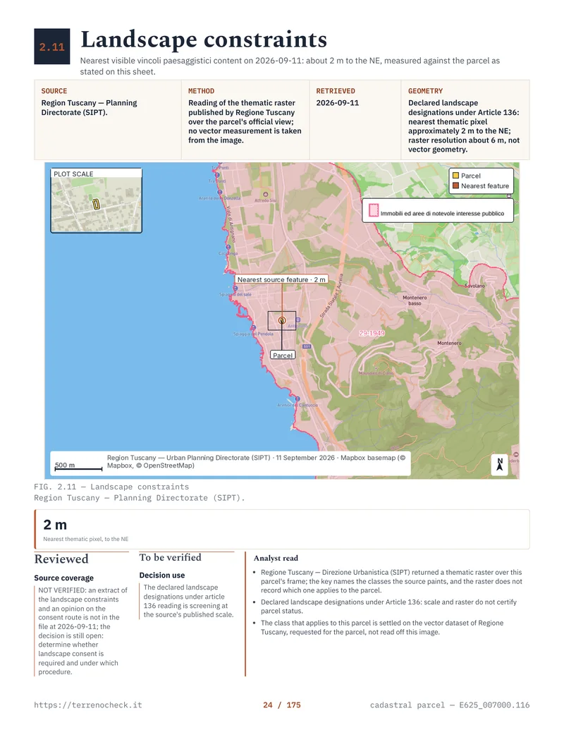
No. The nearest thematic pixel falls about 2 m north-east of the boundary, but the raster resolution is about 6 m: at that scale the source does not record which class applies to the parcel.
Source and date
Region of Tuscany, Planning Directorate (SIPT). Official view over the parcel’s frame, read on 11 September 2026; no vector measurement is taken from the image.
Relation to the parcel
Declared landscape designations under Article 136: nearest thematic pixel about 2 m to the NE, raster resolution about 6 m.
What this means for the purchase
About two metres of clearance, on pixels of about six metres, says one thing: the parcel sits on the edge of the painted area and the landscape file belongs before the deposit. The dossier records the constraint extract and the consent-route opinion as NOT VERIFIED, both missing from the file on 11 September 2026.
Before the deposit
Ask the Region for the vector dataset covering the parcel and the municipality for the applicable decree with its constraint sheet. Have a licensed technician overlay those documents on the survey and state whether landscape consent is required, and under which procedure.
Limitation of the reading. The reading is cartographic and holds at the scale the source publishes. It does not certify the status of the parcel and does not replace the decree, the regional landscape plan or the heritage office’s opinion.
Read the full guide for this check →