Pre-purchase property check · Italy
Know the parcel
before you buy it.
Find the land on the map, confirm the correct cadastral boundary and receive a preliminary dossier on the parcel’s geometry, identity and immediate context.
EUR 39 one language · EUR 49 both · total prices · about 10 minutes per edition · no subscription
Check a parcel
Find the land. Confirm the exact boundary.
One parcel, one evidence file
Every page starts from the boundary you confirm.
The report starts with the decision frame and parcel, then separates planning, site, hazards, environment, services, documents and the purchase decision. A source that was not obtained remains labelled as such.
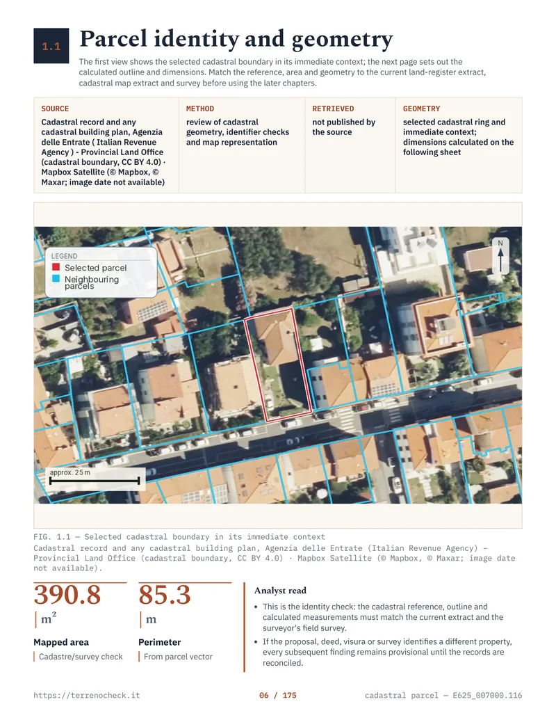 Real report page · Agenzia delle Entrate
What is included today
Eleven chapters, from parcel to decision.
The report separates cadastral identity, planning, site, hazards, environment, services and documentary evidence without presenting gaps as completed checks.
Confirmed parcel
Cadastral reference, selected geometry, centroid and satellite context. Everything else is measured against this boundary.
Agenzia delle Entrate 01Boundaries and dimensions
Area, perimeter, coordinate register, edges and shape diagnostics.
Geometry calculation 02Administrative setting
Municipality, province, region, plus national and local parcel location.
Administrative boundaries 03Nearby parcels
Nearby cadastral records actually returned around the boundary, with nothing invented where the service gave nothing.
Agenzia delle Entrate 04Buildings and land use
OSM features mapped near the parcel, with source scope and limits.
OpenStreetMap 05Road proximity
Distance to mapped roads, explicitly distinguished from a legal right of access.
OpenStreetMap 06Maps from the report
Nine maps of one real parcel.
Nine maps extracted from the Livorno E625_007000.116 report, rendered on 11 September 2026. Every tile comes from that same preliminary report.
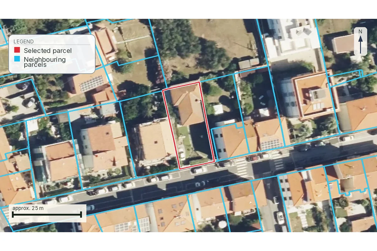
The boundary among neighbouring parcels
390.8 m² read from the cadastral WFS: the parcel is outlined among its neighbours.
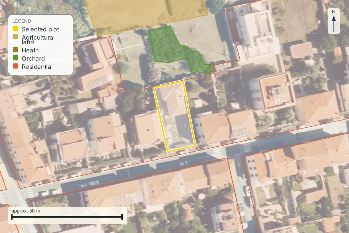
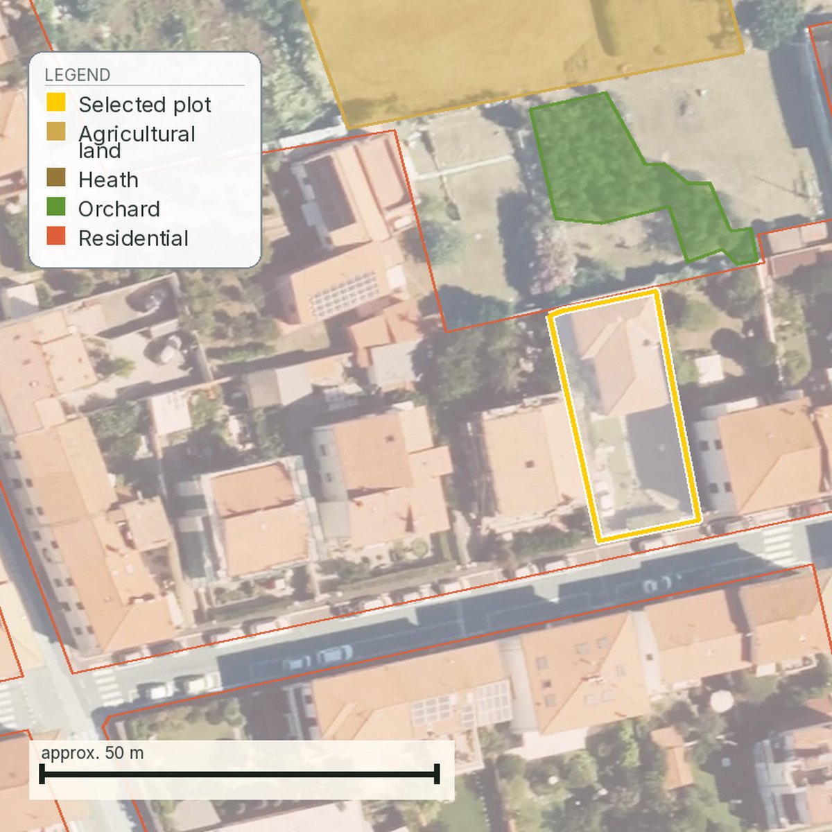
How the surrounding land is used
Mapped physical uses show the setting, without establishing planning permission.
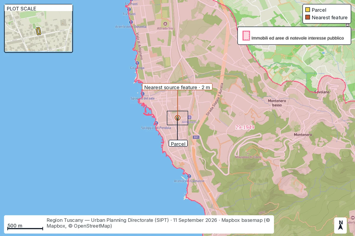
Landscape protection around the parcel
The regional map shows published landscape constraints around the parcel.
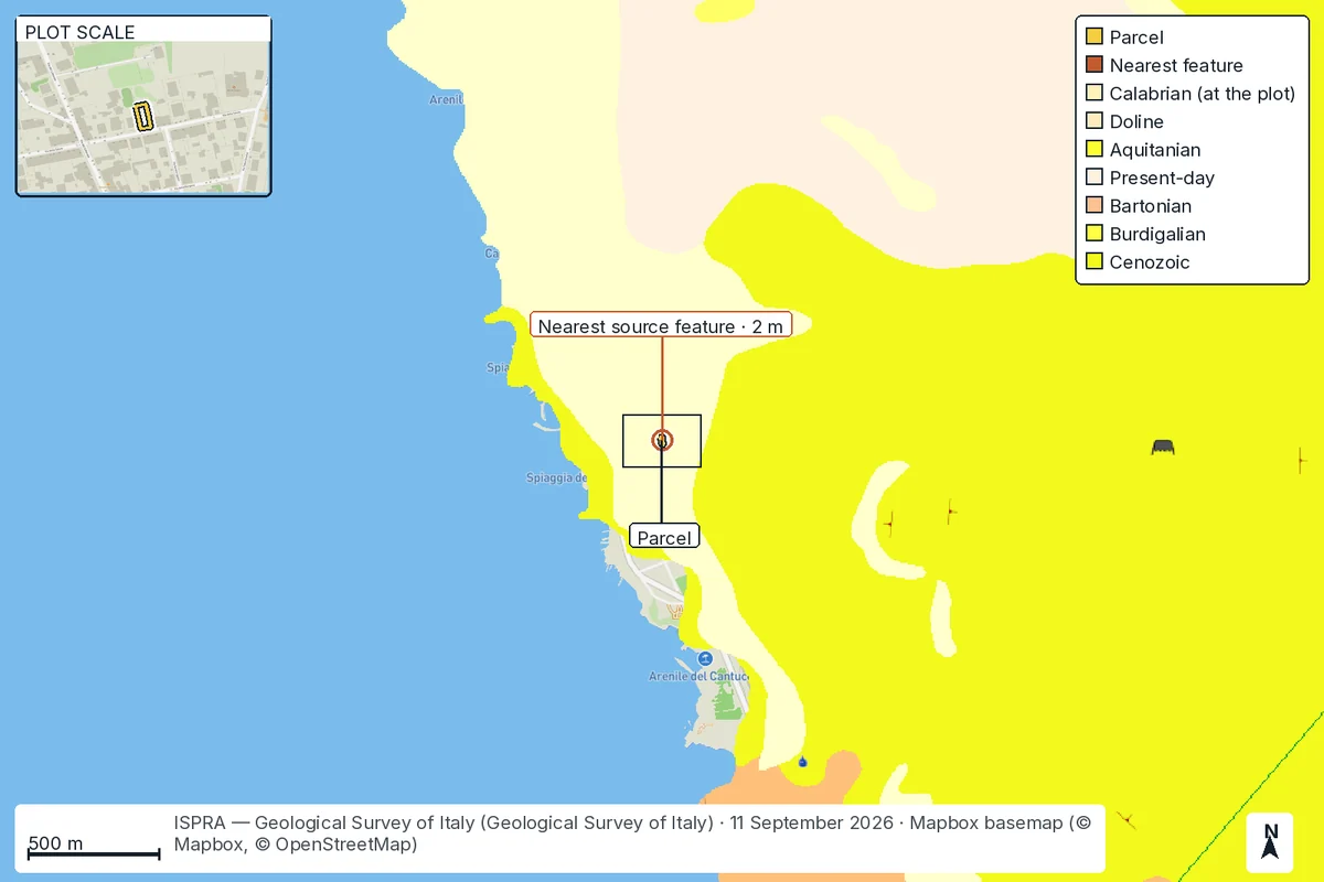
Geology beneath the parcel
The geological map shows the mapped units around the parcel.
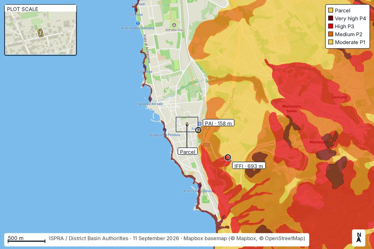
Areas exposed to landslides
Nearest PAI hazard 158 m from the boundary, nearest IFFI record 693 m.
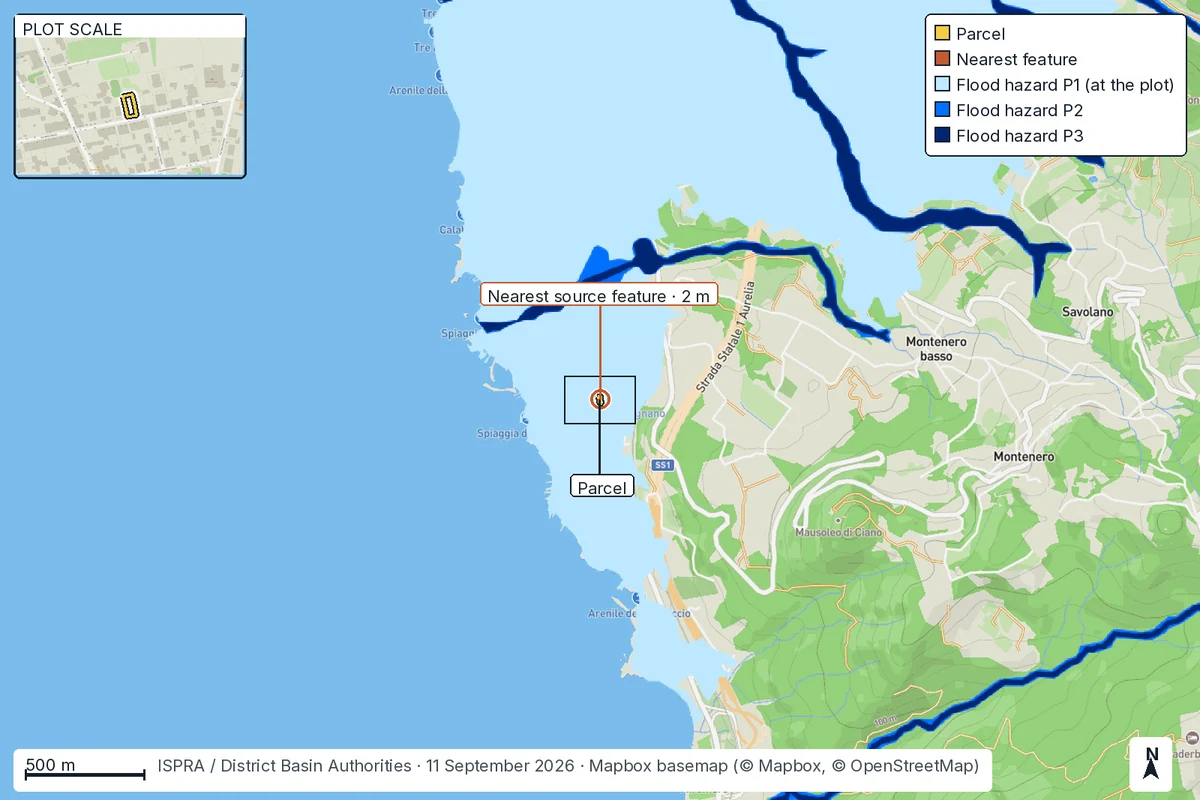
Where flood hazard is mapped
The PAI map shows flood hazard in the area around the parcel.
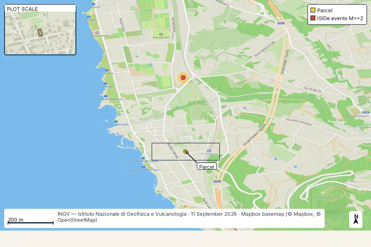
Recorded earthquakes nearby
The nearest recorded epicentre sits 549 m north, in the catalogue since 1985.
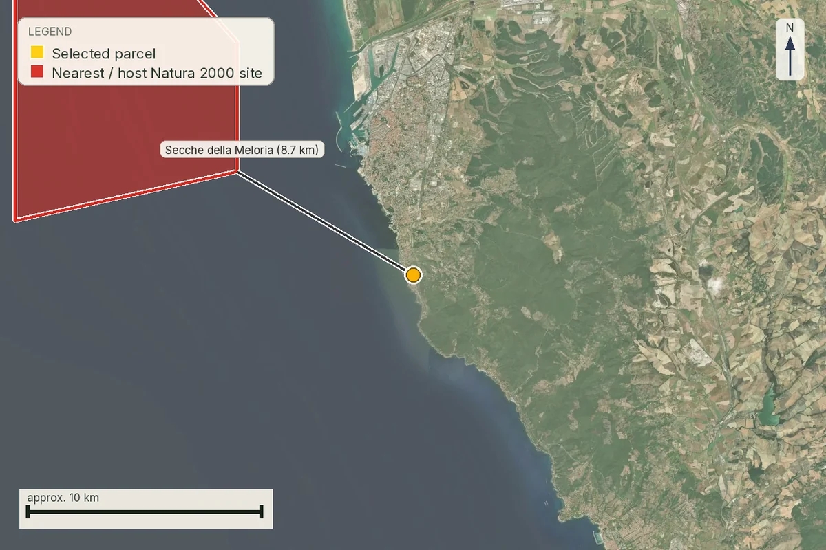
Protected natural areas nearby
The cadastral outline intersects no Natura 2000 site returned by the source.
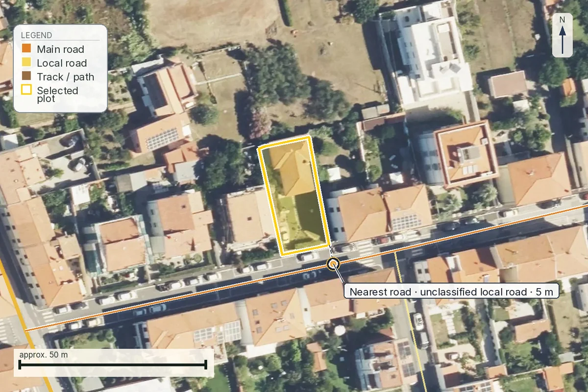
The nearest road to the boundary
Via della Salute runs about 5 m from the boundary; access still needs checking on site.
How it works
From the map to the dossier in four steps.
Find the place
Search a town, address or coordinates in Italy.
Select the boundary
Click a parcel and, if needed, merge adjacent ones.
Confirm the selection
Verify that the highlighted boundary is the correct one.
Get the dossier
Each report takes about 10 minutes. The current edition produces about 175 pages; the total grows only where sources return useful content.
Sample dossier
Read a whole dossier before you pay for one.
The sample dossier is a real report, produced by the same system that will build yours: the same maps, the same sources, the same eleven chapters. Where a source returned nothing, the page says so instead of presenting the check as finished.
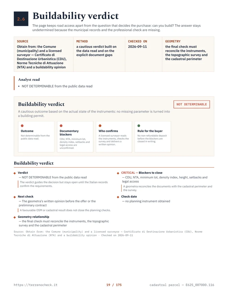
More than a map
A risk brief for anyone buying in Italy.
The public dossier is parcel E625_007000.116 in Livorno, Tuscany, generated on 11 September 2026: 175 pages, eleven chapters, the same sources we will read for your parcel.
Pricing
One dossier. One or two languages.
Choose Italian, English or both: one copy for you and one for the notary, surveyor or engineer working with you.
One complete edition — Italian or English
Choose one language now for the confirmed parcel. You can add the other edition later from the private link in the delivery email.
- Ready in about 10 minutes per report
- About 175 pages in 11 chapters
- Maps, measurements, sources and limitations stated
- The questions to take to your notary and surveyor
Two complete editions — Italian + English
One complete Italian PDF and one complete English PDF in the same order. Useful when the buyer and the adviser work in different languages.
- Everything in the single-language edition
- Italian and English included from the start
- Same findings, same maps, same sources
- No second purchase later
Total prices: 39 EUR for one language, 49 EUR for both, and 10 EUR to add the second language. You can buy the addition from the report's delivery page, reached through the private link in the delivery email. No tax, fee or other charge is added.
Scope and limits
What TerrenoCheck does, and where it stops.
Is this legal due diligence?
No. It is an automated screen and does not verify ownership, title, encumbrances or legal buildability. Take it to local professionals.
Are the boundaries official?
The screening view uses cadastral map data. Before committing, confirm with the appropriate official extract and professional survey when needed.
Does the dossier already include planning and natural hazards?
Yes, as screening of the available sources, in separate chapters with stated limitations. No map alone amounts to a conclusive planning or legal verification.
Can I merge parcels?
Yes, up to 10 parcels that genuinely share an edge. The dossier is anchored to the merged boundary.
Considering land or a home in Italy?
Confirm the parcel first and build the initial evidence file to take to your surveyor, engineer or notary.