
The pre-purchase checklist for foreigners buying land in Italy
A parcel in an Italian listing is not yet a buildable, accessible property. This checklist shows what to identify, request, verify and price before you sign.
Contents
- 1. Fix the parcel before you investigate it
- 2. Get the document pack, and understand what each paper can and cannot tell you
- Visura and map extract
- Certificato di destinazione urbanistica, or CDU
- APE
- Atto di provenienza
- Agibilità and condono paperwork for buildings
- 3. Test buildability against the actual municipal plan
- 4. Look for constraints that can freeze the plan
- Landscape constraint
- Hydrogeological restraint
- PAI, flood and landslide classes
- Usi civici
- 5. Prove access; a photograph is not enough
- 6. Ask utilities for feasibility, not optimism
- 7. Budget the purchase, not just the advertised price
- 8. Do the checks in this order
Start with the parcel, not the picture in the listing. A photograph can show a field; it cannot tell you which particella is for sale, whether a road is legally available, or whether the advertised house has any planning basis.
Before signing, establish the parcel, municipal rules, legal access, constraints, service feasibility and full cost. Italian land deals often fail in that order. Use this workflow before purchase, then have the relevant Italian professionals advise on title, planning and building matters for the parcel.
If you are outside the EU/EEA, ask the Notariato to check your capacity to buy before paying a non-refundable deposit. EU/EEA citizens generally buy under the same conditions as Italians; for other buyers, reciprocity, a bilateral agreement or a qualifying residence permit can change the answer.
1. Fix the parcel before you investigate it
Ask for the cadastral identifiers in writing, not a village name and a screenshot:
- Comune catastale, the cadastral municipality.
- Foglio, the map sheet.
- Particella, also called mappale, the parcel number.
- Subalterno, where a building or urban unit is divided into separate units. A bare rural parcel normally has no subalterno; an apartment, garage or other building unit can have one.
Then obtain a current visura catastale and, where history is unclear, a visura storica. The Agenzia delle Entrate describes the visura as a record of identifying data, classification, area or cadastral income and recorded rights. It can catch a wrong foglio or missing parcel, but it is not the deed or land registry.
Put the seller’s identifiers, listing plan and cadastral map in the same folder. Compare the shape, neighbours, road edge and building footprint. The estratto di mappa is the land map; the planimetria catastale is a building unit’s floor plan. Ask for the first when buying land, and remember that a mapped track is not proof of a legal road.
The cadastral office records fiscal and identification information. The notary must compare it with the Registri Immobiliari, where ownership, mortgages, seizures, easements and other rights are investigated. A seller’s name on a visura is a lead, not the end of the title check.
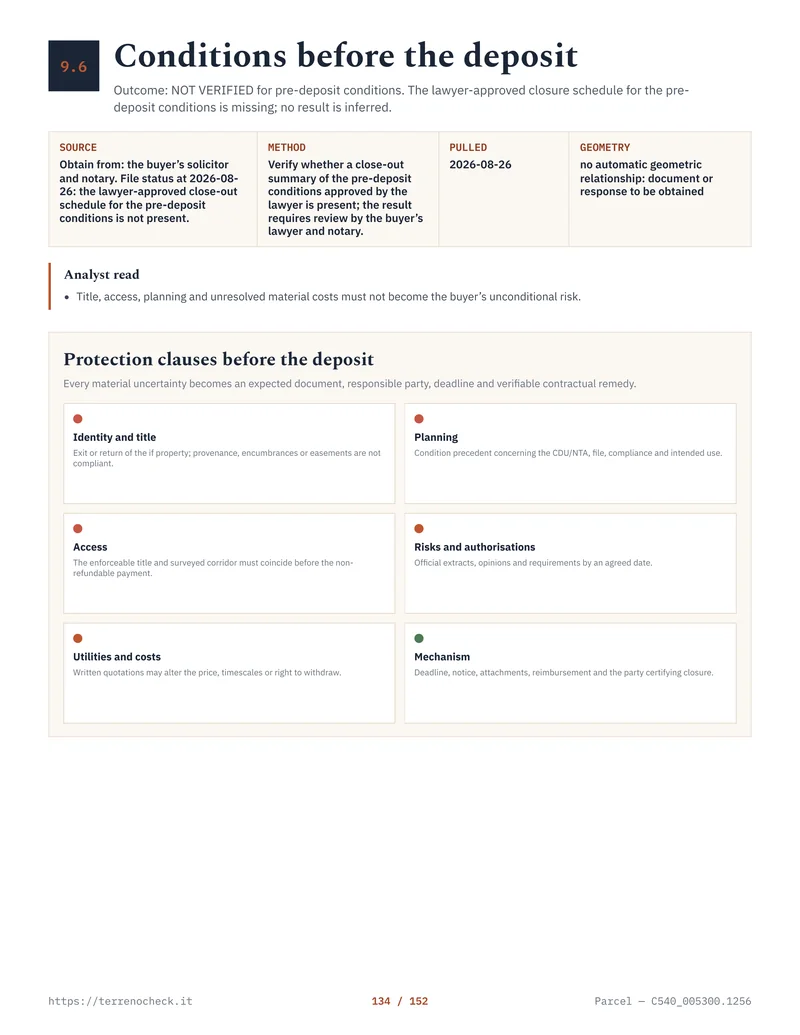
Pages from the delivered dossier
 Open the full page
2. Get the document pack, and understand what each paper can and cannot tell you
Visura and map extract
The current visura tells you how the parcel is recorded now. The historic version can reveal changes in area, classification, holders and cited acts; read annotations for reservations, splits, merged parcels and unexplained updates.
The map extract helps compare recorded geometry with the ground. It is not a boundary survey. If a fence, driveway or boundary affects price, commission a surveyor before the offer becomes binding.
Certificato di destinazione urbanistica, or CDU
For many transfers of land between living people, Article 30 of DPR 380/2001 requires the certificato di destinazione urbanistica to be attached to the deed. The certificate comes from the competent municipal office and has a narrow exception for certain land serving a building below 5,000 square metres, not every small rural plot.
The municipality has 30 days to issue it; it remains valid for one year if the seller declares that planning instruments have not changed. Those are statutory figures, not a promise of speed. The CDU states planning destination and prescriptions, but it does not calculate a permitted house or remove other constraints. Ask the notary before relying on the law’s narrowly framed substitute declaration for a late certificate.
The CDU guide goes deeper into its scope and limits.
APE
An attestato di prestazione energetica, or APE, concerns a building or building unit, not an empty field. Under D.Lgs. 192/2005, Article 6, it is issued for buildings that are built, sold or newly let, subject to exclusions, and remains valid for 10 years unless works change the energy class. If the sale includes a building, check that the APE relates to the unit; it measures energy performance, not legality.
Atto di provenienza
The atto di provenienza is the seller’s deed showing how the current owner acquired the property: sale, inheritance, donation, division or another transfer. Ask for the full deed because it may contain a servitude, co-ownership share, restriction, reserved right or parcel mismatch. The notary independently checks the public registers. Choose your own notary before a binding offer.
Agibilità and condono paperwork for buildings
If there is a building, ask for its planning file, titles, variations, structural filings, segnalazione certificata di agibilità or older habitability certificate, and utility evidence. Under DPR 380/2001, Article 24, the filing is due within 15 days of finishing relevant works. That deadline does not make an old building without a paper automatically illegal, and the paper does not prove every alteration matches the approved project. For an older building or filled/industrial land, add environmental checks to the file.
If the seller mentions a condono, ask for the application, protocol, plans, oblazione and charges receipts, opinions and final municipal title in sanatoria, or a written explanation of what remains open. The main frameworks are Law 47/1985, Law 724/1994 and Article 32 of Decree-Law 269/2003, converted by Law 326/2003. Date, abuse type, constraints and the municipal file decide which applies. “Condono requested” is not a completed amnesty; have a building professional reconcile the built condition, approved drawings and file.
3. Test buildability against the actual municipal plan
“Buildable land” in an advertisement is a claim to investigate, not a planning category. Your instrument may be called PRG, PUC, PGT, structural plan or operational plan. Names vary by region and municipality; Rome’s PRG and Tuscany’s planning catalogue illustrate why maps and NTA must be read locally.
Obtain the plan map and NTA for the exact parcel. Find the zoning class, permitted uses, minimum lot area, indice di edificabilità, height and coverage limits, setbacks, access, agricultural-business qualifications, implementation-plan requirements, and whether development rights have been consumed or transferred. Ask the municipal Sportello Unico per l’Edilizia for a written response where the project depends on a judgement call.
The national starting point is DPR 380/2001, Article 12: a building permit must conform to planning instruments and regulations, and depends on primary urbanisation works or a lawful commitment to provide them. A large parcel is not a house.
“Agricultural” usually means the opposite of what a foreign buyer hopes. A Zone E label identifies agricultural use in DM 1444/1968, but permitted building types, density, agricultural-operator requirements and other restrictions come from regional and municipal rules. A holiday house for a non-farmer is not a universal entitlement.
A blog formula is a trap. Confirm whether the index is territorial or land-based, which portion is eligible, whether the calculation is tied to an agricultural holding, and which restrictions reduce or eliminate the result. Then have an architect or surveyor test the proposed footprint.
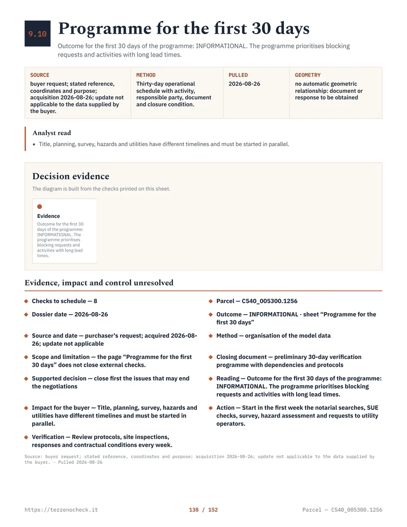 Open the full page
4. Look for constraints that can freeze the plan
Constraints can make the intended use expensive, slow or impossible. Check them before pricing the land as if a house were certain, especially for coastal property.
Landscape constraint
The vincolo paesaggistico may arise from a ministerial or regional measure, or directly from categories in Article 142 of D.Lgs. 42/2004, including certain shores, rivers, forests and civic-use land. Use MiC’s SITAP as an initial search, then confirm the regional plan and municipal file.
Under Article 146 of D.Lgs. 42/2004, works affecting protected values need authorisation before the building permit; it is normally effective for five years. Minor works may follow DPR 31/2017, but a satellite image cannot settle that.
Hydrogeological restraint
The vincolo idrogeologico comes from R.D.L. 3267/1923, covering land vulnerable to denudation, instability or disrupted water flows. Under D.Lgs. 152/2006, Article 61, the regions exercise these functions. A green municipal map does not prove excavation or a driveway is permitted, and seismic classification is a screening input rather than a structural design result.
PAI, flood and landslide classes
The Piano di Assetto Idrogeologico is a basin or district instrument, not one national map with one universal legend. ISPRA’s mosaic is useful for screening, but the adopted map, rules and authority depend on the district. The Po district uses P1–P4; elsewhere labels may differ or separate hazard from risk.
Check the correct Autorità di Bacino Distrettuale, regional PAI or PGRA, and municipal layer. Read the rules, not just the colour. A PAI intersection warrants a geologist. The PAI guide covers the map-reading traps; a blank small web layer is not a clean bill of health.
The ISPRA Dissesto idrogeologico in Italia: pericolosità e indicatori di rischio, Edizione 2024 (Rapporti 415/2025), together with its PAI landslide-hazard mosaic v5.0 - 2024, makes the national figures precise. Its denominator is 302,068 km², the mapped national territory. Within it, 28,801 km² (9.5%) is in PAI P3–P4, the high and very high landslide-hazard classes, while 30,194 km² (10.0%) is in the medium flood-hazard scenario based on the 2020 ISPRA mosaic, with a 100–200-year return period. The report’s updated landslide population indicator uses the 2021 Census and counts 1.28 million residents in P3–P4 areas; its medium-flood indicator uses 2020 data and counts 6.8 million residents. These are national screening aggregates, not a finding about any particular parcel.
Usi civici
Usi civici are collective rights or burdens with roots in Law 1766/1927 and R.D. 332/1928. A parcel can look privately held and still require a regional investigation. Ask for the inventory, maps and any civic-use rights, legittimazione, affrancazione, liquidation or other definitive act. “Everyone has always used it” is not a legal answer.
5. Prove access; a photograph is not enough
Walk the route in wet weather if you can, then inspect the legal route.
The strip of asphalt or dirt may be a public road, private road, tolerated track, farm route or somebody else’s land. A map line does not establish a right of way. Look in the deed, later deeds, transcriptions and subdivision agreements for a servitù di passaggio, including its route, width, permitted use and maintenance.
The Civil Code defines a predial servitude as a burden on one plot for another’s utility. Article 1051 can support a compulsory passage claim for an enclosed parcel, normally against compensation. That is a remedy, not an access right to assume at the viewing; a court dispute is a poor substitute for a signed, transcribed easement.
Ask a surveyor to draw the route and a notary to verify title and registrations. Ask the municipality or road owner whether a new driveway, culvert or entrance needs permission. Reaching the boundary is not permission to open an entrance.
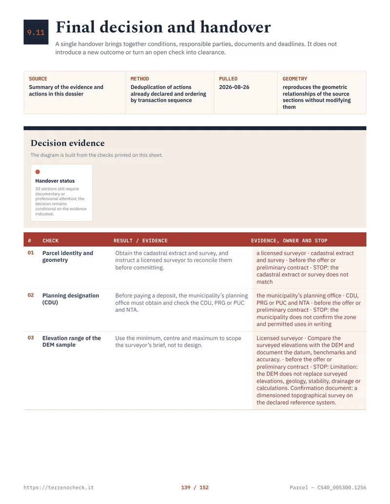 Open the full page
6. Ask utilities for feasibility, not optimism
“Services nearby” is not a utility connection. Get a written answer tied to a proposed point on the parcel.
For electricity, ask the local distributor for a connection estimate. ARERA says standard charges include distance, requested power and a fixed contribution, with the amount in the estimate. E-Distribuzione publishes 2026 figures for its network: €78.81 per kW in low voltage, €209.62 up to 200 metres from the reference cabin, then €105.08 per additional 100 metres beyond 200 and up to 700 metres. Those figures cover regulated components only; digging, easements, road crossings and internal wiring sit outside them.
Water and sewer costs are more local. Identify the operator, confirm the service area, and request the connection point, pressure, route, excavation responsibility, tariff and extension contribution. A well or septic tank adds permits, maintenance and discharge constraints. Nobody can give you a reliable national connection price from a desk.
Utility connection figures and rules
| Utility check | Published figure or rule | What you still need to price | Source |
|---|---|---|---|
| Low-voltage electricity power quota, 2026 | €78.81/kW | Requested power, VAT, internal works and unusual works | e-distribuzione 2026 charges |
| Low-voltage electricity distance quota, up to 200 m, 2026 | €209.62 | Exact cabin distance and connection type | e-distribuzione 2026 charges |
| Additional distance, over 200 to 700 m, 2026 | €105.08 per 100 m or fraction over 50 m | Trenching, road crossings, easements and distributor estimate | e-distribuzione 2026 charges |
| Standard connection estimate | Must be stated in the distributor’s quote | Timing, authorisations and works charged to the applicant | ARERA electricity information |
Source: e-distribuzione 2026 charges and ARERA electricity information
7. Budget the purchase, not just the advertised price
The buyer usually pays purchase taxes, the notary’s fee and technical and legal checks; the notary generally collects taxes for the Agenzia delle Entrate. Confirm the agency commission, VAT and trigger date. Tax classification is case-specific: the 15% agricultural-land rate is the one in Article 1 of Tariff Part I annexed to DPR 131/1986, in force to 31.12.2026, and carried forward as the consolidated successor by D.Lgs. 123/2025, Annex 1, Tariff Part I. It applies in the specified non-farmer/IAP case, not to every parcel called “land”.
Purchase cost lines to budget
| Cost line | Published figure or scope | Who normally pays or arranges it | Source and caution |
|---|---|---|---|
| Agricultural-land registration tax | 15% in the specified non-farmer/IAP case | Usually buyer, collected by the notary | DPR 131/1986, Tariff Part I, Article 1 (in force to 31.12.2026) and D.Lgs. 123/2025, Annex 1, Tariff Part I, Article 1 (consolidated successor); summary in Notariato tax aspects, not a universal land rate |
| Ordinary non-relieved private home, comparison only | 9% registration, €50 mortgage, €50 cadastral | Usually buyer | DPR 131/1986, Tariff Part I, Article 1 (in force to 31.12.2026) and D.Lgs. 123/2025, Annex 1, Tariff Part I, Article 1 (consolidated successor); the two €50 fixed taxes are in Article 10(3) of D.Lgs. 23/2011; summary in Agenzia guide, not a land quote |
| Notary, survey, planning, geologist or engineer | No national fixed figure used here | Buyer unless agreed otherwise | Quote depends on value, terrain, documents and intended project |
| Agency commission and VAT | Contract-specific | As stated in the mediation agreement | Confirm percentage, VAT and trigger date before signing |
| Access, utilities, trenches and permits | Written quote or case-specific | Party responsible under the deed or quote | Route, third-party land and road crossings dominate |
Source: DPR 131/1986, Tariff Part I, Article 1 (in force to 31.12.2026), D.Lgs. 123/2025, Annex 1, Tariff Part I, Article 1 (consolidated successor), D.Lgs. 23/2011, Article 10(3), and Consiglio Nazionale del Notariato, tax aspects and purchase rules
Treat the total as price + taxes + professional work + commission + connection and access work + contingency for an unresolved file. There is no honest national percentage for the last four items, so put each open cost in the offer as a condition, seller deliverable or price deduction.
The tax guide covers the mechanics behind these lines, while the agricultural-land guide deals with pre-emption.
8. Do the checks in this order
Use this order before committing serious money:
- 01 First viewing + coordinatescheap; reversible; money hard to recover: none
- 02 Foglio/particella/subalterno + visura + map extractcheap; reversible; none
- 03 Atto di provenienza + Registri Immobiliari + access/easementslow cost; reversible; none
- 04 CDU + PRG/PUC map + NTA + municipal answerlow cost; reversible; none
- 05 Landscape, hydrogeological, PAI/PGRA and civic-use checkslow cost; reversible; none
- 06 Written electricity, water and sewer feasibilitylow cost; reversible; none
- 07 Surveyor/architect/geologist reviewprofessional fee; usually stoppable; fee may be spent, deposit still avoidable
- 08 Notary title/tax review + conditional offer or preliminary contractmaterial commitment; limited reversibility; deposit, penalty or agency fee may be hard to recover
- 09 Registered final deedpurchase price and taxes paid; not practically reversible; recovery normally requires a later sale or dispute
Source: Consiglio Nazionale del Notariato, buying and selling real estate
Cheap is reversible. A signed commitment may not be.
Source: DPR 380/2001, Article 30; DPR 380/2001, Article 24; D.Lgs. 192/2005, Article 6; D.Lgs. 42/2004, Article 146
Source: e-distribuzione, 2026 connection charges, including ARERA Delibera 575/2025/R/eel, Allegato C
Sources
- Agenzia delle Entrate, cadastral services and FAQ
- Agenzia delle Entrate, The new cadastral extract
- Agenzia delle Entrate, buying a home and taxes
- Normattiva, DPR 26 April 1986, no. 131, Tariff Part I, Article 1, registration-tax rates (in force to 31.12.2026)
- Gazzetta Ufficiale, D.Lgs. 123/2025, Annex 1, Tariff Part I, Article 1, registration-tax rates (consolidated successor)
- Normattiva, D.Lgs. 14 March 2011, no. 23, Article 10(3), the €50 fixed mortgage and cadastral taxes
- Normattiva, DPR 380/2001 Article 12
- Normattiva, DPR 380/2001 consolidated text
- Normattiva, DPR 380/2001 Article 24
- Normattiva, D.Lgs. 192/2005 Article 6
- Normattiva, Law 47/1985 Article 40
- Normattiva, Law 724/1994 Article 39
- Normattiva, D.L. 269/2003 Article 32, converted by Law 326/2003
- Normattiva, Law 1766/1927 on civic uses
- Normattiva, R.D.L. 3267/1923 on hydrogeological restraint
- Normattiva, R.D. 332/1928 on civic-use procedure
- Normattiva, Civil Code Articles 1027 and 1051
- Normattiva, D.Lgs. 152/2006 Article 61
- Normattiva, D.Lgs. 42/2004 Article 146
- Normattiva, D.Lgs. 42/2004 Article 142
- Official Gazette, Ministerial Decree 1444/1968
- Normattiva, DPR 31/2017 simplified landscape procedure
- Comune di Roma, PRG and implementing rules
- Regione Toscana, municipal planning instruments
- MiC SITAP landscape-constraint portal
- MiC, landscape authorisation procedure
- ISPRA, Dissesto idrogeologico in Italia, Edizione 2024, Rapporti 415/2025
- ISPRA, PAI landslide-hazard mosaic v5.0 - 2024
- ISPRA, flood-hazard areas, 2020 national mosaic
- ISPRA IdroGEO hazard-check explanation
- Autorità di Bacino del Po, PAI hazard classes
- Consiglio Nazionale del Notariato, buying and selling real estate
- Consiglio Nazionale del Notariato, classic legal checks
- Consiglio Nazionale del Notariato, tax aspects
- Consiglio Nazionale del Notariato, purchase rules
- ARERA, electricity connection information
- e-distribuzione, 2026 connection charges
- Consiglio Nazionale del Notariato, notarial services for foreigners
- Italian Ministry of Foreign Affairs, reciprocity condition