
Flood and landslide risk in Italy: read the PAI
A PAI or PGRA map can stop a building project long before a buyer notices the problem on site. Here is how to read the classes, find the operative rules, and keep evidence for one Italian parcel.
Contents
- Who publishes the map you are looking at?
- What the classes say, and what they do not say
- The flood numbers are not small, and they overlap
- Landslide figures: the map is a planning signal, not a slope inspection
- Do not miss the vincolo idrogeologico
- A parcel check that survives an argument later
- Price, mortgage and insurance
- The limit no map can remove
If a house is on a slope, beside a stream, below a scarred hillside, or in a valley that has flooded before, the asking price is not the whole question. Can the land do what you are buying it for? A PAI or PGRA designation can block an extension, a new home or a bank valuation.
Start with the pre-purchase checklist if you are still assembling the file. This piece is about the documents that decide whether a hazard patch matters to your plot.
Who publishes the map you are looking at?
Italy does not have one national PAI with one national set of building rules. The operative planning unit is the river district, and the publisher you need is the Autorità di Bacino Distrettuale. Under Legislative Decree 3 April 2006, no. 152, it prepares the basin plan and its functional stralci. Article 65 calls the approved plan a territorial sector plan and says its declared prescriptions can bind public bodies, private parties and other territorial plans.
The PAI, Piano di Assetto Idrogeologico, is the plan for hydrogeological hazard and its land-use rules. The PGRA, Piano di Gestione del Rischio di Alluvioni, is the flood-risk management plan required under Legislative Decree 23 February 2010, no. 49. A PGRA map may show the flood scenario while detailed prohibitions remain in the PAI, regional rules or local planning. The Southern Apennine authority says this in its third-cycle material.
Then there is ISPRA’s IdroGEO, the national entry point for PAI landslide and flood mosaics and the IFFI landslide inventory. Use it to find the district and decide whether a parcel deserves attention. It is not the document that gives you a right to build. ISPRA says its national flood indicator uses data updated to 2020 and that district authorities continuously update their maps.
Names are not stable across Italy. The national landslide mosaic uses P4, P3, P2, P1 and AA. The Arno data service uses P.F.4, P.F.3 and P.F.2: active, potentially unstable inactive, and stabilised inactive landslides respectively. For floods, ISPRA uses HPH, MPH and LPH; a Southern Apennine plan may display P3, P2 and P1. PF is a district-specific prefix, not a universal fifth class. Read the local legend and NTA.
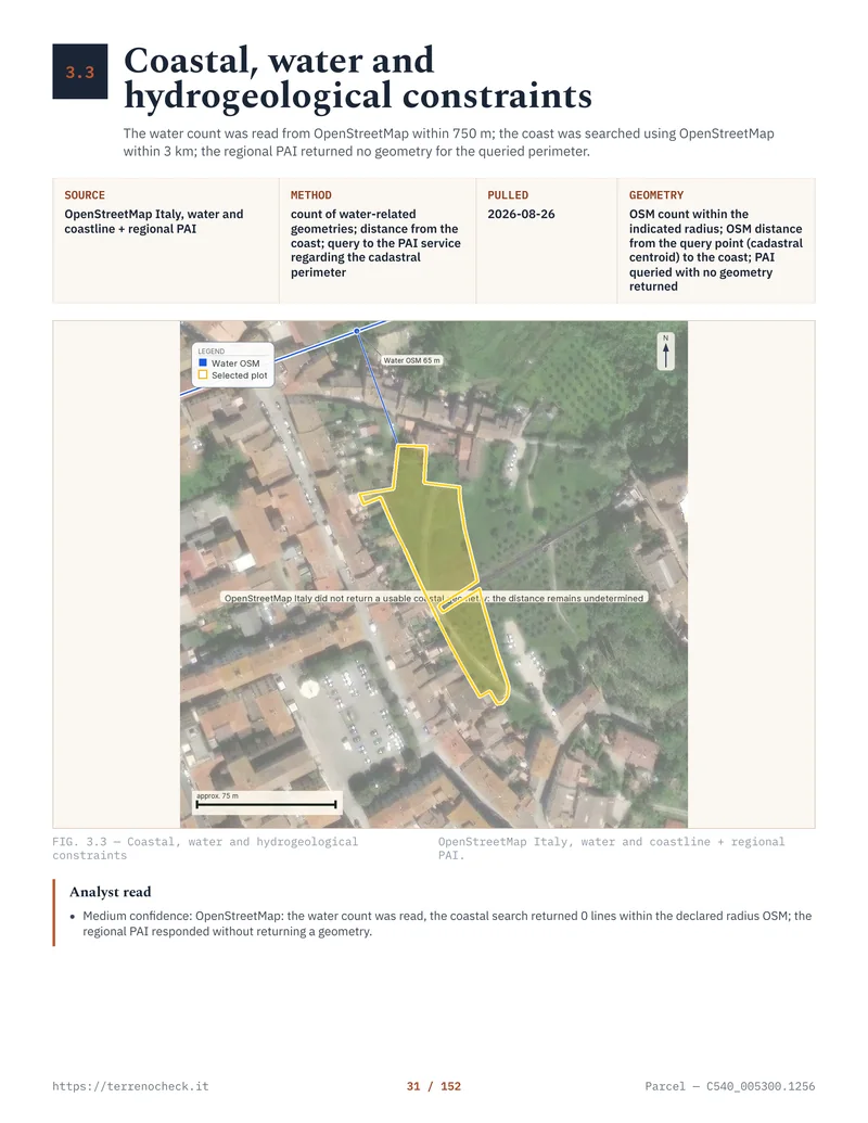
Pages from the delivered dossier
 Open the full page
What the classes say, and what they do not say
The first trap is treating “hazard” as “damage”. Pericolosità describes the possibility or intensity of a process. Rischio also depends on exposure and vulnerability. A field can have high hazard and low current risk because it has no building. That does not make a new house acceptable.
The table is a reading guide, not a national permit schedule. The local NTA, regional law and municipal plan can narrow the result.
How the map labels constrain a buyer’s question
| Map label | Published meaning or example | Building and extension consequence | Insurance and finance consequence |
|---|---|---|---|
| P4 / PF4 | Very high landslide hazard in ISPRA’s national mosaic; PF4 in the Arno layer means active landslide hazard. | Treat new building as a stop signal until the authority’s NTA proves otherwise. Existing works can be limited to defined maintenance or safety interventions. | Expect close underwriting, exclusions or a refusal for some covers. A lender may treat the usable value as lower than the asking price. |
| P3 / PF3 | High landslide hazard; PF3 in the Arno layer refers to inactive but potentially unstable landslides. | New work, enlargement, excavation or a new access route may require a specialist compatibility study and an authority opinion. In some areas the intended use is not viable. | The buyer pool shrinks when the buildable envelope is uncertain. Get an insurer’s written answer, not an agent’s assurance. |
| P2 / PF2 | Medium landslide hazard; PF2 in the Arno layer refers to stabilised inactive landslides. | It is not a clean bill of health. The NTA can require geological evidence, drainage or stabilisation and can regulate earth movement. | A policy may be available, but landslide and flood wording still needs checking. The bank’s valuer will want the restriction and the proposed remedy documented. |
| P1 / AA | Moderate hazard, or an “area of attention” in the national landslide mosaic. | Lower class does not equal permission. AA means the authority has flagged an area requiring attention; it does not mean “safe to build”. | Usually easier to explain than P4, but a missing or provisional study can still affect valuation. |
| P3/P2/P1 flood labels, or HPH/MPH/LPH | Flood scenarios. The same three probability bands can be presented with different labels by different publishers. | The class must be read with water depth, flow, local rules and the proposed work. A high-probability area can prohibit new construction; a lower scenario can still control finished-floor levels or compatibility studies. | Flood cover, inundation cover and landslide cover are separate questions in policy wording. Do not assume one includes the others. |
Source: ISPRA and district-plan legends; read the applicable local NTA
For example, Appennino Meridionale measures prohibit demolition-reconstruction and new construction in new P3 areas within R4 subareas, with public-work exceptions. That is not every P3. Tuscany’s Regional Law 24 July 2018, no. 41, Article 3 prohibits new construction and morphological transformations in defined aree golenali, or floodplain areas. Never infer permission from a colour.
An application can therefore move through several gates. A study may be enough, a compatibility report or district opinion may be required, or the rule may say no new building. Extensions are often treated differently from maintenance, reconstruction and safety works. The footprint matters, as do retaining walls, septic systems, pools, roads and utilities. A buyer who checks only the house centre point has not checked the project.
The PAI restriction also has to reach local planning. Article 65(4) of Legislative Decree 152/2006 makes approved plan provisions immediately binding where the plan declares them effective. Article 65(6) requires regional urban implementation measures within 90 days of publication, gives territorial authorities six months to adopt necessary planning adjustments after communication, and provides for regional action after nine months from publication if the adjustment is not made. Those are plan-implementation deadlines, not a promise that your building permit will arrive in 90 days.
See what you can build under an Italian PRG. Read it with the PAI, not instead of it.
The flood numbers are not small, and they overlap
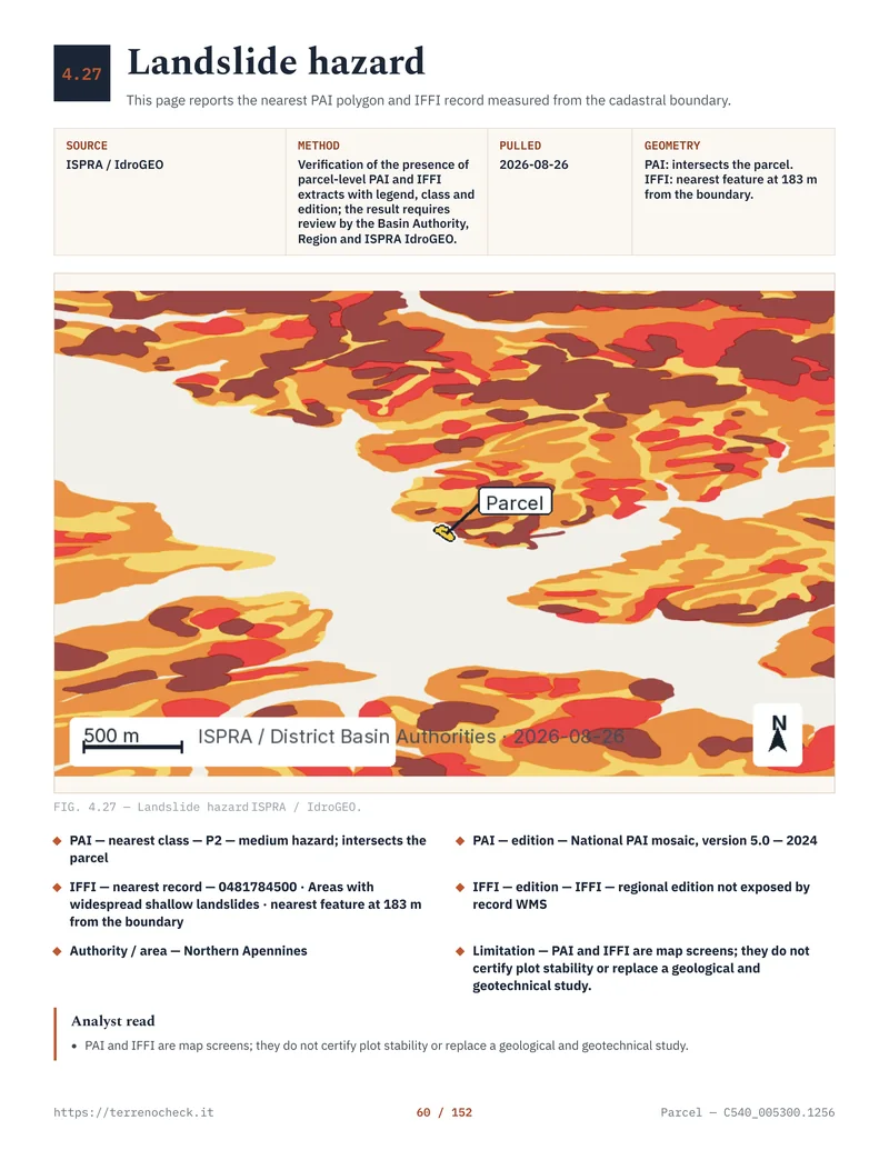
ISPRA’s national flood mosaic is a scale check, not a parcel answer. These second-cycle figures use data updated to 2020; the scenarios are probability bands, not areas to add together.
ISPRA flood scenario footprints
| ISPRA flood scenario | Italian label | Return-period band | Potentially floodable area | Share of national territory |
|---|---|---|---|---|
| High Probability Hazard | HPH, frequent floods | 20–50 years | 16,224 km² | 5.4% |
| Medium Probability Hazard | MPH, infrequent floods | 100–200 years | 30,194 km² | 10.0% |
| Low Probability Hazard | LPH, rare or extreme events | More than 200 years | 42,376 km² | 14.0% |
LPH is where buyers make the wrong leap: “It only floods in an extreme event, so it has no effect.” It can still affect building position, access, insurance, finished levels, drainage and resale. An HPH polygon on a wide holding may not affect a dwelling if the usable building area is elsewhere. Geometry and proposed use decide the outcome.
 Open the full page
Landslide figures: the map is a planning signal, not a slope inspection
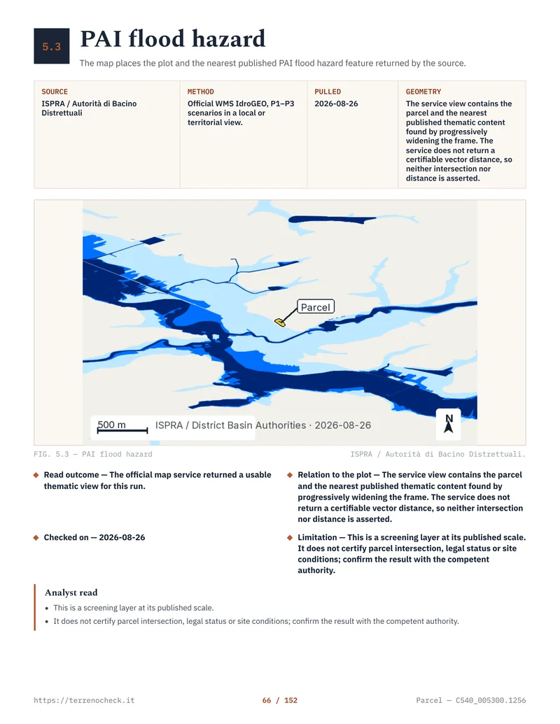
ISPRA’s 2024 PAI mosaic covers 69,530 km² of mapped landslide hazard and attention areas, 23% of Italy. P3 and P4 together cover 28,801 km², 9.5%. These figures do not tell you whether a retaining wall is sound or a previous cut weakened the slope.
ISPRA 2024 landslide and flood indicators
| ISPRA 2024 indicator | Area or population | Share or unit | What it measures |
|---|---|---|---|
| PAI landslide hazard plus attention areas | 69,530 km² | 23% of Italy | All five harmonised landslide classes plus AA in the national mosaic |
| P3 plus P4 landslide hazard | 28,801 km² | 9.5% of Italy | High and very-high classes with the most restrictive land-use controls |
| Residents in P3 plus P4 areas | 1.28 million people | 2.2% of national population | Population located in the two higher landslide-hazard classes |
| Residents in medium flood hazard P2 | 6.8 million people | 11.5% of national population | Population in the national medium flood scenario |
| Municipalities affected by mapped landslide, flood, coastal-erosion or avalanche areas | 7,463 | 94.5% of 7,899 municipalities | Combined national indicator, not a parcel finding |
Source: ISPRA, Dissesto idrogeologico in Italia: pericolosità e indicatori di rischio, Edizione 2024, Rapporti 415/2025
Source for this table: ISPRA, “Dissesto idrogeologico in Italia: pericolosità e indicatori di rischio, Edizione 2024”, Rapporti 415/2025.
- Region90 days from publication in the regional bulletin to issue the necessary urban implementation provisions
- Territorial authorities6 months from communication of those provisions to adopt necessary planning adjustments
- Region, if the local authority has not actedUp to 9 months from publication of plan approval before adjustment ex officio
Source: Legislative Decree 3 April 2006, no. 152, Article 65(6), Normattiva
Do not miss the vincolo idrogeologico
The vincolo idrogeologico is a separate constraint. It is older than the modern PAI system and often disappears from an agent’s cheerful summary of “no flood risk”. Royal Decree-Law 30 December 1923, no. 3267, Article 1 covers land of any nature or destination where certain uses could cause public damage through denudation, loss of stability or disturbance of the water regime. The purpose is protection of soil and water, not the same classification exercise as PAI or PGRA.
The maps, competent office and procedure are implemented through regional rules. Regione Toscana publishes a hydrogeological-constraint layer and warns that parts of it are merely ricognitivo, an inventory, and that woodland and the constraint can require an on-site assessment. Emilia-Romagna’s official forms treat it as a distinct authorisation question under Article 61(5) of Legislative Decree 152/2006 and RDL 3267/1923.
Ask separately: “Is this parcel inside the vincolo idrogeologico, and does my proposed work require authorisation or notification under this region’s rules?” A “no PAI overlap” answer does not answer it. The seismic zones in Italy article covers another constraint often mixed into this conversation.
 Open the full page
A parcel check that survives an argument later
Here is the order I use when a buyer wants evidence rather than a coloured screenshot.
First, identify the land exactly. Match the municipality, foglio and particella in the visura catastale workflow to the Agenzia delle Entrate cadastral geometry. A dropped pin is not a boundary. Check adjoining parcels if the project needs a driveway, septic field, retaining wall or access route.
Second, find the river district and open its official PAI and PGRA portal. Record the plan act, date, layer, legend, NTA version and whether the map is adopted, proposed, indicative or superseded. No polygon is not proof of no hazard: the query may have failed.
Third, intersect the full parcel polygon with the hazard polygons, then run the building footprint and enabling works separately. A thin P3 strip across the only access can matter more than a broad P2 patch at the rear. For a slope, inspect uphill catchment, drainage lines, scarps and the toe. IdroGEO and IFFI screen; the district’s adopted map and NTA control the planning question.
Fourth, read the rule attached to that exact class. Search for new construction, enlargement, change of use, demolition and reconstruction, earth movement, drainage, roads and safety works. Note any required study, authority opinion or mitigation certificate. Do not accept “the engineer can solve it” until the work is priced and the rule allows it.
Fifth, obtain the Comune’s current planning extract and CDU. The certificato di destinazione urbanistica (CDU) article explains it. Compare PAI/PGRA with the Comune’s PRG, PUC or other operative instrument. If they do not match, resolve the document problem; do not choose the favourable map.
Finally, ask in writing. Send the parcel plan, intended use and map references to the Comune and relevant regional or district office, using a qualified professional where a study is indicated. Keep replies, PDFs, map files, URLs, dates, legend screenshots, cadastral identifiers, reports and quotations. If the seller says a retaining wall was “already approved”, ask for the act and conditions.
Price, mortgage and insurance
A hazard designation does not produce a statutory discount. There is no honest Italian rule saying “P3 means 20% off”. The market effect comes from use. If the class removes the house site, blocks an extension or makes access and drainage expensive, the land is worth less to the relevant buyer. Pay for the use you can document, not the optimistic use in the listing.
Mortgage lenders make their own credit and collateral decisions. Banca d’Italia explains that the bank normally relies on a professional valuation and commonly finances up to 80% of it, although policies differ. A PAI flag does not automatically cancel a mortgage by national law. It can lower valuation or trigger CDU and planning requests. Ask for a finance condition if the purchase depends on a particular building outcome.
Insurance is even less suitable for guesswork. In its 2024 review of retail catastrophe policies, IVASS found “frana o franamento” included by three companies in flood/inundation cover and excluded by seven in its sample. The 2026 review stresses covered events, deductibles, excesses, limits and exclusions. “Natural catastrophe cover” does not necessarily include a landslide.
Before signing, ask for a quote on the actual building and address, disclose the PAI/PGRA class, and get written confirmation of flood, inundation, overflow, flash flood, landslide and earth-movement cover. Record deductibles, maximum indemnity and exclusions. If the answer is verbal, it is not evidence.
The limit no map can remove
PAI and PGRA maps are made for basin and territorial planning. They generalise terrain, water flow and past events over many parcels. A polygon crossing a parcel does not describe the building site. ISPRA directs users to the competent district authorities for purposes beyond its national indicator.
No desk map tells you the bearing capacity of one field, the condition of a private culvert, the depth of fill or the stability of a cut slope. A field outside the polygon can still need a site investigation. A field inside P2 can be usable for one proposal and impossible for another.
The honest conclusion is often conditional: “This parcel intersects the named PAI class; the footprint requires the following study; the official rule allows or prohibits the following works; the evidence is current as of this date.” It is less satisfying than “low risk”. It can keep a buyer from paying for a house that exists only in a brochure.
Sources
- Normattiva — Legislative Decree 3 April 2006, no. 152, Article 65
- Normattiva — Legislative Decree 23 February 2010, no. 49
- Normattiva — Royal Decree-Law 30 December 1923, no. 3267
- ISPRA — National PAI landslide-hazard mosaic
- ISPRA — Dissesto idrogeologico in Italia, Edizione 2024, Rapporti 415/2025
- ISPRA — Flood-hazard areas and scenarios
- ISPRA — IdroGEO and natural-hazard databases
- Autorità di Bacino Distrettuale dell’Appennino Settentrionale — Arno PF layer
- Autorità di Bacino Distrettuale dell’Appennino Meridionale — Calabria–Lao PAI/PGRA materials
- Autorità di Bacino Distrettuale dell’Appennino Meridionale — 2025 P3/R4 safeguard measures
- Autorità di Bacino Distrettuale del Fiume Po — current PAI documentation
- Regione Toscana — Regional Law 24 July 2018, no. 41
- Regione Toscana — hydrogeological constraint data note
- Agenzia delle Entrate — cadastral cartography WFS
- Regione Emilia-Romagna — official building declaration form, hydrogeological constraint
- IVASS — 2024 analysis of catastrophe-risk policies
- IVASS — 2026 analysis of catastrophe-risk policies
- Banca d’Italia — mortgage guide