
Certificato di destinazione urbanistica (CDU): what it says about your land
The CDU is the Italian planning certificate a land buyer cannot afford to treat as paperwork. It identifies the planning rules attached to the parcel, but it is not a building permit.
Contents
- The legal rule: Article 30 of DPR 380/2001
- What the certificate actually contains
- How to read the main fields
- Destinazione urbanistica and zona omogenea
- Indice di edificabilità fondiaria and territoriale
- Vincoli, fasce and notes
- How to request a CDU
- CDU versus permesso di costruire
- What bad news looks like on the page
The CDU states the planning designation and prescriptions recorded for the identified cadastral parcels. An agent’s description, a listing that says terreno edificabile or a screenshot of a planning map does not replace it.
The certificato di destinazione urbanistica, usually shortened to CDU, is the municipality’s certificate of the planning prescriptions affecting identified land. It tells you which designation and rules the municipality records for the cadastral parcels at issue. It can expose an agricultural designation, a public-service reservation, an index too low for the proposed project, or a restriction the advert never mentioned.
For most lifetime transfers of rights in land, Article 30(2) of DPR 380/2001 requires the CDU to accompany the deed. Without it, the act is null. Do not leave it until the notary’s appointment.
The CDU is a planning document. It is not proof of ownership, a survey of the boundary, a feasibility study, or permission to build. Those distinctions are where buyers save money.
The legal rule: Article 30 of DPR 380/2001
The national rule is Article 30 of Presidential Decree no. 380 of 6 June 2001, the Testo Unico dell’edilizia. Article 30 is headed “lottizzazione abusiva”, or unlawful subdivision, but paragraph 2 contains the CDU rule used in ordinary land transfers.
It says that lifetime acts, public or private, transferring or creating real rights in land, or dissolving co-ownership, are null and cannot be executed or registered without a CDU containing the area’s planning prescriptions. A sale is the familiar example, but the wording is broader.
There is a narrow exception when the land is an appurtenance of a building recorded in the New Urban Building Cadastre and the total appurtenant area is below 5,000 square metres. Both conditions matter. A separate rural parcel does not become exempt because the seller calls it a garden.
The rule is clear: land over 5,000 m² cannot use this exception. If Article 30(2) applies, the CDU must be attached or the act is null. Below 5,000 m², have the notary confirm the legal appurtenance before relying on it.
Article 30 figures
| Article 30 figure | What it means | Source |
|---|---|---|
| 5,000 m² | The narrow exception ends below this area, and only for land appurtenant to a building recorded in the New Urban Building Cadastre. | DPR 380/2001, Article 30(2) |
| 30 days | The competent municipal office has a peremptory term to issue the CDU after the application is submitted. | DPR 380/2001, Article 30(3) |
| 1 year | The CDU remains valid from issue if the alienor or co-owner declares that the planning instruments have not changed. | DPR 380/2001, Article 30(3) |
Source: DPR 380/2001, Article 30
- Day 0complete CDU application
- Day 30statutory municipal issue term
- Issue date + 1 yearvalidity only if planning instruments have not changed and the required seller/co-owner declaration is made
Source: DPR 380/2001, Article 30(3)–(4), Normattiva
- NO — not an Article 30(2) actAsk the notary to classify the act
- YES — land is not an appurtenance of a building recorded in the New Urban Building CadastreCDU mandatory
- YES — qualifying appurtenance, total area is not below 5,000 m²CDU mandatory
- YES — qualifying appurtenance and total area below 5,000 m²Narrow exception may apply, notary to confirm
Source: DPR 380/2001, Article 30(2), Normattiva
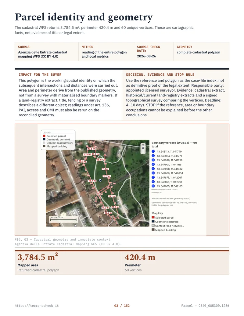
Pages from the delivered dossier
 Open the full page
What the certificate actually contains
The CDU follows the planning instruments in force or adopted for the municipality. The instrument may be a PRG (Piano Regolatore Generale), PUC, PGT, PSC, or another local plan. The label is not the answer. The applicable map and its NTA, the Norme Tecniche di Attuazione, are.
The Comune di Roma describes its CDU as documenting land uses under the current PRG, other adopted or approved instruments and higher-level constraints. That describes the job, not a uniform format. A small comune may issue a short table; another several pages of notes and references.
For each cadastral parcel, look for its destinazione urbanistica (planning use), zone or sub-zone and NTA reference, indici and parameters such as index, minimum lot, coverage, height, setbacks and permitted uses, plus vincoli and prescriptions such as landscape, archaeological, hydrogeological, flood-plan, road, cemetery, public-use or expropriation constraints.
The certificate does not establish ownership, prove the cadastral outline is the legal boundary, certify access or utilities, or confirm a building’s planning regularity. Start with the visura catastale and cadastral parcel check for identity, then have title and transfers checked through the notary.
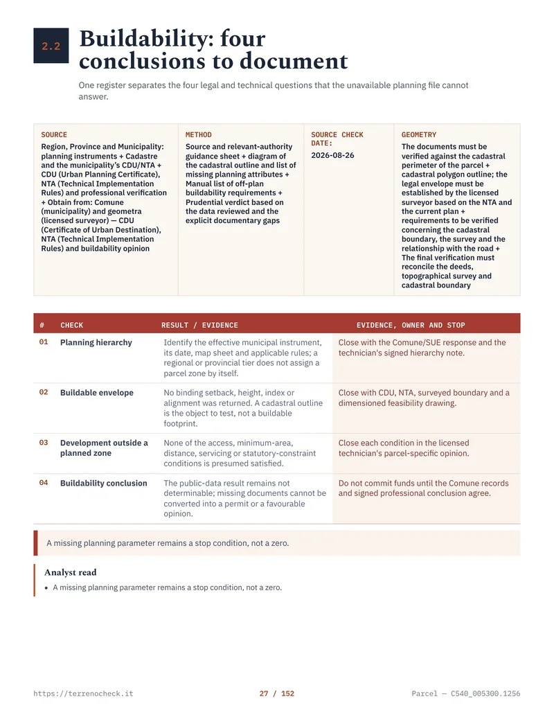
Nor does it calculate the house you have in mind. Indice fondiario 0.03 mc/mq is not approval for a 150 m² villa. The index may apply to a particular surface, include existing volume, require a minimum lot or agricultural qualification, or be reduced by a constraint or implementation plan. A technician must do that arithmetic.
 Open the full page
How to read the main fields
Destinazione urbanistica and zona omogenea
DM 1444/1968, Article 2 defines the familiar zone omogenee. Local plans may use different codes, and the NTA controls the permitted uses.
DM 1444/1968 zone categories
| Zone | The DM 1444/1968 category | What a buyer should not assume |
|---|---|---|
| A | Historic, artistic or environmental value, including qualifying surroundings. | Renovation or demolition is unrestricted. |
| B | Built-up territory outside A, meeting the decree’s density and coverage conditions. | Every vacant-looking parcel is an ordinary house plot. |
| C | New settlement complexes, undeveloped or below zone B thresholds. | Construction is immediate without a plan or urbanisation. |
| D | New industrial or similar production settlements. | A private home is an ordinary permitted use. |
| E | Agricultural land. | A holiday house is allowed for any buyer. Regional and municipal rules matter. |
| F | Equipment and facilities of general interest. | Unoccupied land is privately usable. A public reservation can be serious. |
Source: Official Gazette, Ministerial Decree 1444/1968
Read the local code beside the letter. E2, C1, F3 and similar codes point to the NTA article where the use, minimum plot, index and conditions live. That sentence often matters more than the zone letter.
Indice di edificabilità fondiaria and territoriale
The national standard glossary published in the Official Gazette in 2016 defines indice di edificabilità territoriale (IT) as the maximum surface or volume buildable on a territorial surface, including existing buildings. Indice di edificabilità fondiaria (IF) applies it to the buildable land surface, again including existing buildings. A plan may use mc/mq, mq/mq, SLP, SUL or a local equivalent.
That wording matters. A farmhouse, shed or legally recognised volume can consume some or all of the capacity. The certificate may quote the index without doing the parcel-specific calculation. Ask a qualified local technician to identify the calculation surface, existing volume, assigned rights and every NTA condition.
Territorial surface can include the wider transformation area and public-service or urbanisation areas. Fondiaria is the surface left for building use after relevant deductions. Confusing them can make a paper right look larger than the right available on the ground.
Vincoli, fasce and notes
Treat the constraints section as questions, not a green light. A CDU may refer to a vincolo paesaggistico under D.Lgs. 42/2004, a regional landscape plan, protected water, archaeology or a local rule. The Ministry of Culture’s Vincoli in Rete service warns that its data may be out of date or under modification and says a specific property needs validation by the competent ministry office.
For flooding and landslides, there is no single national colour map. ISPRA harmonises areas from PAI plans prepared by District Basin Authorities. The competent authority depends on the parcel: the Autorità di Bacino Distrettuale dell’Appennino Meridionale, for example, publishes PAI maps and records perimeter changes under Article 68 of D.Lgs. 152/2006. Check the current district plan even if the CDU mentions a PAI code.
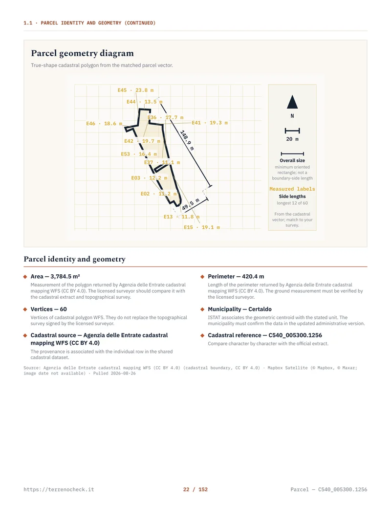
These levels are not interchangeable: Article 30 is national, designation is municipal within regional law, and PAI rules belong to the competent district authority.
 Open the full page
How to request a CDU
Request it from the Comune where the land is located, usually its Ufficio Urbanistica or certification service. Search for certificato di destinazione urbanistica; a general planning map is not the certificate.
The usual sequence is:
- Match the seller’s land to the current foglio and particella identifiers. Request every parcel in the purchase, not just the one in the advert. The pre-purchase checklist sets out the wider order.
- Download the current form and read its map, signature and payment instructions. Some communes accept online applications; others require PEC or a portal account.
- Attach the requested cadastral map, identification, delegation if needed and payment evidence. Rome asks for a map no more than three months old with marked parcels. Florence asks for two €16 revenue stamps, €103 in secretarial fees and identification where the application is not digitally signed.
- If it is for a deed, follow the notary’s delivery instruction. Florence asks for the rogating notary’s PEC address. Save the protocol receipt, issued PDF and date; do not rely on an agent’s old scan.
Article 30(3) of DPR 380/2001 gives the municipality 30 days. That is the legal term, not a service guarantee from an incomplete email. Florence says its average time is under seven working days after acceptance as complete and offers no urgency procedure. Other offices take longer, especially where parcel identifiers or historic planning references need checking.
There is no national average turnaround I can responsibly quote. It varies by Comune and by whether the application is complete.
The cost is set locally, and there is no single Italy-wide CDU price. These two verified municipal examples are published figures, not a national tariff:
Published municipal CDU costs
| Municipality and published service | Secretarial fee | Stamp duty shown | Published timing | Source checked |
|---|---|---|---|---|
| Florence | €103 | €32 total for two €16 stamps | 30 days by law; average under 7 working days after acceptance | Comune di Firenze CDU service |
| Rome | €100 ordinary CDU; €150 historic CDU | €32 where required | 30 days under DPR 380/2001, Article 30(3), when the file is complete | Roma Capitale CDU procedure |
Source: Comune di Firenze CDU service and Roma Capitale CDU procedure
The listed totals are €135 in Florence, €132 for Rome’s ordinary CDU and €182 for its historic CDU where two stamps apply. Rome’s document states that a historic CDU requested for a succession is exempt from stamp duty under Table B annexed to D.P.R. 642/1972. Check the Comune page before paying.
Source: Comune di Firenze CDU service and Roma Capitale, CDU procedure and fees — comune.roma.it · source document
While you wait, keep the transaction reversible. Ask for the current plan map and NTA article, but treat them as working documents until the CDU arrives. Ask the notary about conditioning completion on satisfactory planning and title checks. Request any building’s planning file separately. Near a river, coast, historic centre, protected area or steep slope, start the PAI and flood or landslide check and landscape-constraint check in parallel. The files are different.
CDU versus permesso di costruire
Under Articles 10 and 12 of DPR 380/2001, new construction is subject to a permesso di costruire, which must conform to current planning instruments, building regulations and urban-planning rules. It is issued by the competent municipal office under Article 13 for a defined project and applicant, with the required technical documents, approvals and contributions.
The CDU is earlier and narrower. It records the prescriptions attached to the land. A favourable CDU may show a zone where a use is contemplated, perhaps with an index. It does not approve your design, confirm urbanisation, waive landscape authorisation, satisfy seismic rules, resolve access, or bind another authority.
If the certificate says residenziale or edificabile, ask: “under what NTA article, with what index, on what surface, after which setbacks, with what plan or authorisations?”
For PRG or PUC building rights, use what you can build under Italy’s planning instruments. The CDU is one input, not the answer.
What bad news looks like on the page
Bad news is often written in bureaucratic Italian. Watch for these phrases and read the NTA reference beside them:
- Area inedificabile or inedificabilità: no building right under that rule, subject to the exact wording and any limited exceptions.
- Destinazione a servizi pubblici, verde pubblico, attrezzature pubbliche or standard urbanistici: the plan may reserve the land for a public function rather than a private house.
- Vincolo preordinato all’esproprio: a planning reservation connected with a possible public acquisition. The duration, procedure and compensation questions require professional review.
- Fascia di rispetto: a setback or protection strip. It may relate to a road, railway, cemetery, watercourse, coast, airport or other infrastructure. The distance and permitted works depend on the applicable rule.
- Edificazione subordinata all’approvazione di un piano attuativo: you may be looking at a development that needs an implementation plan or convention before an individual permit can be considered.
- Lotto minimo, indice fondiario, volume massimo: these are not filler. A lot can be in a nominally favourable zone and still fail the minimum-area or volume calculation.
- Zona E with agricultural-operator conditions: the national zone label does not answer the regional and municipal question of who may build, what may be built, and for which agricultural activity.
None can be judged from the certificate alone. Zona E is not an automatic “no”; Zona B is not an automatic “yes”. Ask in writing for the NTA article, permitted use, relevant surface, index after existing volume, minimum lot, required plan and responsible authority.
If the rule changed, ask for adopted and approved plan dates and consider a historic CDU. One-year validity does not freeze planning law; the old paper is not a time machine.
Sources
- Normattiva, DPR 380/2001, Article 30
- Normattiva, DPR 380/2001, Articles 10-13
- Protezione Civile, DPR 380/2001 consolidated text, Article 30
- Official Gazette, Ministerial Decree 2 April 1968, no. 1444
- Official Gazette, Intesa on the standard building-regulation glossary, 16 November 2016
- Comune di Firenze, CDU service
- Roma Capitale, CDU procedure and fees
- Comune di Roma, guide to CDU content and planning constraints
- Ministero della Cultura, Vincoli in Rete
- Normattiva, D.Lgs. 42/2004, Article 142
- Normattiva, D.Lgs. 152/2006, Article 68
- ISPRA, hydrogeological hazard report, 2024 edition
- ISPRA, IdroGEO and PAI hazard data
- Autorità di Bacino Distrettuale dell’Appennino Meridionale, PAI modifications and maps
- Normattiva, D.P.R. 26 October 1972, no. 642, Table B of acts exempt from stamp duty