
Coastal property in Italy: the strip that changes everything
Coastal layers a buyer must keep separate
| Layer | Reference | Practical effect |
|---|---|---|
| Landscape band | Shoreline; 300 m nationally | Landscape controls can apply |
| Regional coastal plan | Sardinia up to 2,000 m; Puglia 300 m | Rules can be tighter |
| Maritime public domain | Official delimitation | Not included in private sale |
Source: D.Lgs. 42/2004 Article 142; Sardinia D.G.R. no. 33/5 of 2009; Puglia PPTR Articles 41 and 45
A ruin near the water is not a shortcut to a seaside house. The 300-metre national constraint, maritime state land, regional plans and flood maps can each remove a different part of the deal.
Contents
- The national 300-metre rule is a landscape constraint
- What changes for an extension
- Three coastal distances that buyers confuse
- Demanio marittimo is not the 300-metre band
- The regional layer is where coastal deals diverge
- Sardinia: PPR, fascia costiera and the two-kilometre problem
- Sicily: province, island and municipality matter
- Puglia: the PPTR has a defined coastal category
- Coastal erosion and marine flooding are separate checks
- The ruin that cannot be extended
- The order of checks before you make an offer
Coastal and island property must be checked against landscape protection, maritime public-domain boundaries, regional coastal plans and local planning rules. Existing walls or a low price do not establish a right to restore or extend a building.
That is the familiar version of the coastal purchase. It is also how buyers end up owning four walls, a collapsed roof and no lawful way to add the rooms they paid for in their heads.
This guide is pre-purchase screening, not a permit, title opinion, survey or promise that a parcel can be built on. Start with the Italian land-buying checklist, identify the parcel with the visura catastale, and treat every sales-listing distance as unverified.
The national 300-metre rule is a landscape constraint
Article 142(1)(a) of Legislative Decree 22 January 2004, no. 42, the Codice dei beni culturali e del paesaggio, places coastal territory in a landscape-protected band 300 metres deep from the linea di battigia, including land elevated above the sea. It is a national rule.
The first trap is the word “distance”. Article 142 does not say that every building within 300 metres must be demolished, or that every building beyond 300 metres is buildable. It identifies a protected landscape category. A parcel can cross the line, while a lagoon, harbour, cliff, artificial shore or shifting beach makes it less obvious than an online map suggests. Ask for official cartography and a parcel overlay.
For work that harms the protected landscape, Article 146 requires the owner or holder to submit the project and wait before starting. The Ministry of Culture describes the authorisation as autonomous and prior to the permesso di costruire. See the landscape-constraint guide; neither replaces the other.
Article 146(4) makes the authorisation effective for five years and generally bars issuing it after the work is carried out, apart from the narrow Article 167(4) and (5) cases. “We will regularise it later” is not a plan.
What changes for an extension
A proposed extension inside the 300-metre band may need an ordinary or simplified landscape procedure, depending on the work. The competent body checks the project against the landscape plan or specific protection rules. The Soprintendenza’s role is not ceremonial.
The ordinary Article 146 sequence has published statutory steps set by paragraphs 7 and 8 of that article. The figure shows the intervals. Incomplete files and different procedures can extend the real calendar.
- Competent administration40 days to examine the application and transmit the documents
- Soprintendenza45 days from receipt of the documents to give its opinion
- Competent administration20 days from receipt of the opinion to decide; 105 days is the arithmetic total
Source: Normattiva, D.Lgs. 22 January 2004, no. 42, Article 146.
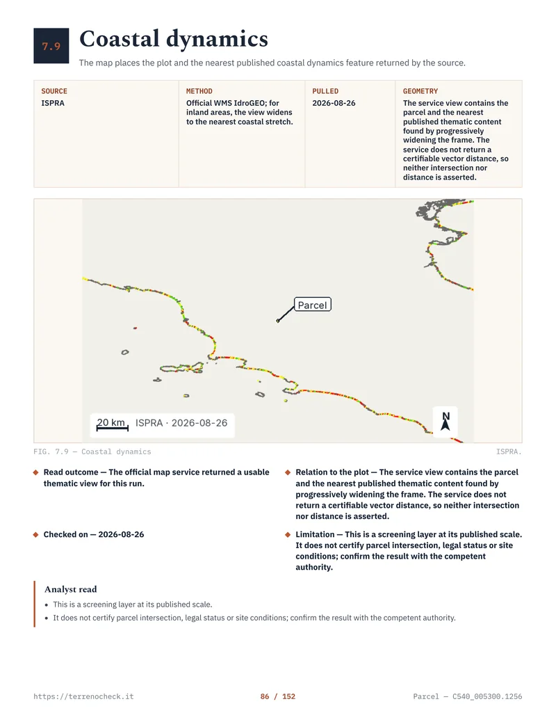
Pages from the delivered dossier
 Open the full page
Three coastal distances that buyers confuse
These are different legal or technical objects. A distance from the sea is not a verdict.
Three coastal distances and their practical effect
| Layer | Reference | Sourced number or rule | Practical effect |
|---|---|---|---|
| Landscape band | Linea di battigia | 300 m nationally under D.Lgs. 42/2004, Article 142, paragraph 1, letter a) | Landscape controls can apply to the project |
| Regional coastal plan | Regional coastline or shoreline | Sardinia uses cited bands to 2,000 m; Puglia PPTR uses 300 m | Regional prescriptions can be tighter or more detailed |
| Building setback | Road, boundary, shore or other defined feature | No single national coastal setback for every parcel | Comes from applicable regional and municipal rules |
| Hazard zone | Modelled flood, erosion or slope geometry | ISPRA P3: 20–50 years; P2: 100–200 years | Hazard rules and technical work may limit the project |
| Maritime public domain | Official administrative delimitation | No universal inland metre figure | Private sale cannot include public-domain land |
Source: Normattiva, D.Lgs. 42/2004 Article 142; Regione Autonoma della Sardegna, D.G.R. no. 33/5 of 2009; Regione Puglia, PPTR NTA Articles 41 and 45
Demanio marittimo is not the 300-metre band
The demanio marittimo is the public maritime domain. Article 28 of the Codice della navigazione, R.D. 30 March 1942, no. 327 names the shore, beach, ports and roadsteads, along with lagoons, river mouths that open to the sea, salt or brackish basins connected to the sea for part of the year, and channels for public maritime use.
There is no universal “first 30 metres” or “first 50 metres” answer that substitutes for identifying the public-domain boundary. The state-owned strip is not created by measuring 300 metres inland. The 300-metre landscape band does not turn every square metre inside it into state property.
Under Article 36 of the Navigation Code, R.D. 327/1942, the maritime administration can grant occupation and use, including exclusive use, for a defined period. That is a concession, not a sale or private freehold title. The MIT describes SID, the Sistema Informativo Demanio marittimo, as the system for maritime-domain concession and use applications.
Public-domain goods are inalienable under Article 823 of the Civil Code, R.D. 16 March 1942, no. 262. Article 829 of the same code requires an administrative declaration for a transfer from public domain to the State’s patrimony. An estate agent’s private deed cannot do that work. If the listing includes a beach, shoreline platform, access strip or harbour area, establish what is private, what is public and whether a concession is being sold as land.
Ask for the verbale di delimitazione, managing office and concession deed, including expiry, fees and obligations. Check whether the parcel touches rather than includes public land.
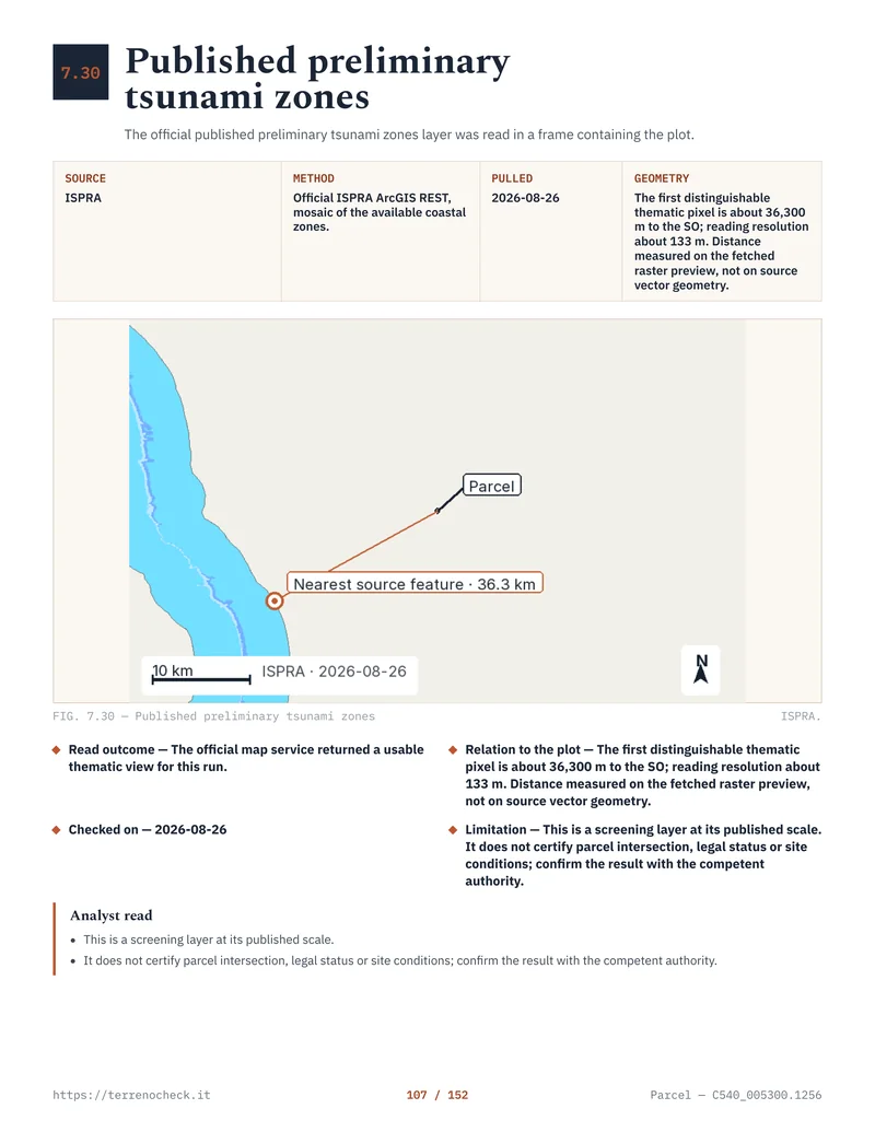 Open the full page
The regional layer is where coastal deals diverge
A national summary is not enough. Regional plans, basin plans and municipal instruments use different maps and can tighten the baseline.
Sardinia: PPR, fascia costiera and the two-kilometre problem
The Sardegna Geoportale publishes the Piano Paesaggistico Regionale, coastal areas and GIS layers. It warns that regional-scale mapping must be specified at detail when municipal plans are adapted. A regional outline is not the Comune’s parcel-scale zoning and NTA.
Sardinian rules show why the national 300-metre sentence is not enough. In the official regional act attached to D.G.R. no. 33/5 of 2009, the band from 300 metres, or 150 metres on minor islands, out to 2,000 metres is treated differently from land beyond 2,000 metres for specified volume-increase rules. Some increases are limited to 10% in the inner band and set at 20% beyond 2,000 metres. Those are rules for that regional regime, not a Sardinia-wide promise about ruins.
On Sardinia, ask for the PPR coastal asset, the municipal plan in force, the NTA article and the rule governing the existing building. Fascia costiera is the beginning of the file.
Sicily: province, island and municipality matter
Sicily has its own planning system. The Region’s official list of landscape plans shows plans by provincial and regional ambits, with statuses including approved, adopted and in concertation. It lists separate plans for the Eolie, Egadi and Pelagie.
That status matters. From adoption and publication, interventions on protected assets must comply with the plan’s prescriptions under Article 143(9) of D.Lgs. 42/2004. A buyer in Mascali must inspect the Catania plan and the Comune’s current PRG, not rely on “Sicily coastal zone”.
Urban planning has its own framework under Sicilian Regional Law 13 August 2020, no. 19, Norme per il governo del territorio, with transitional rules for existing PRGs. The municipal plan, landscape plan and PAI remain separate.
Puglia: the PPTR has a defined coastal category
Puglia’s PPTR NTA define Territori costieri in Article 41 as a 300-metre band from the coastline identified by the Regional Technical Map, including islands. Article 45(2)(a1) generally excludes new building works, subject to the PPTR’s exceptions, including recovery or restoration of landscape and environmental values.
In an official 2020 Puglia decision concerning a treatment plant, the regional office applied Article 45 and recorded that new building works interfering with the coastal asset conflicted with the PPTR. Public works can have specific routes under Article 95. A private buyer cannot assume that route for a ruin.
The answer comes from the parcel’s PPTR intersection, municipal instrument and proposed work, not a beach photograph.
Source: Normattiva, D.Lgs. 42/2004 Article 142; Regione Autonoma della Sardegna, D.G.R. no. 33/5 of 2009; Regione Puglia, PPTR NTA Articles 41 and 45.
Coastal erosion and marine flooding are separate checks
Erosion is a moving shoreline problem. Flood hazard is a water-level problem. A house can be outside the national band and still sit on low ground exposed to coastal flooding; a cliff can face slope instability or wave attack.
ISPRA’s coastal database contains shoreline, backshore and beach layers for different years, including the 1950 IGM line. Its 2024 report says more than 1,890 kilometres of beaches changed significantly between 2006 and 2020, with 965 kilometres advancing and 934 kilometres eroding. These are national observations, not a forecast for one house.
Published coastal-change figures, 2006–2020
| Published figure | Number | What it tells a buyer |
|---|---|---|
| Beaches with significant shoreline change, 2006–2020 | More than 1,890 km | A substantial national change signal, not a parcel forecast |
| Shoreline segments advancing, 2006–2020 | 965 km | Sediment moved seaward or the line advanced in the reported analysis |
| Shoreline segments eroding, 2006–2020 | 934 km | The reported line retreated in the analysis |
| Italian coastline with rigid defence works, 2020 | More than 1,500 km, about 18% | A defence structure is evidence of an engineered frontage, not proof of safety |
Source: ISPRA, 2025 release on the 2024 hydrogeological report; ISPRA coastal database; ISPRA 2026 rigid coastal-defence geodatabase release
Source for the first three rows: ISPRA’s 2025 release on the 2024 hydrogeological report and ISPRA’s coastal database. Source for the rigid-defence row: ISPRA’s 2026 release on the rigid coastal-defence geodatabase. The 965 km advancing and 934 km eroding components sum to 1,899 km, which roughly agrees with ISPRA’s “oltre 1.890 km” headline; these are national summaries, not a parcel-level result.
These are the published national flood-mapping scenarios and areas, including coastal flooding as a type of inundation, not a depth, damage estimate or construction clearance for a particular parcel.
| Scenario | Return period / probability | Area |
|---|---|---|
| High probability P3 | 20–50 years | 16,224 km² |
| Medium probability P2 | 100–200 years | 30,194 km² |
| Low probability P1 | Rare probability or extreme-event scenario | 42,376 km² |
Source: ISPRA, “Le alluvioni”; Normattiva, D.Lgs. 23 February 2010, no. 49.
For an actual offer, use the regional or district authority first. ISPRA mosaics areas mapped by the Autorità di Bacino Distrettuali. The current PAI or PGRA, adopted cartography and local rules matter more than a national screenshot. For Sardinia, start at the Sardegna Geoportale PAI route. For Sicily, the Autorità di Bacino and SITR distinguish downloadable GIS data from the notified PDF cartography with legal effect.
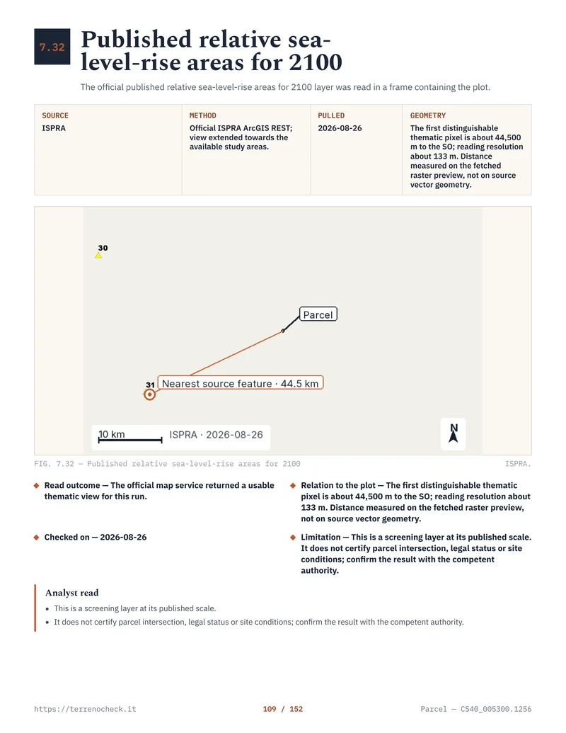
IdroGEO screens PAI landslide and flood mosaics, the IFFI inventory and risk indicators. Record its dataset, vintage, retrieval date and geometry relationship. “No feature returned” is not “no hazard”.
 Open the full page
The ruin that cannot be extended
The purchase that catches foreign buyers most often is a stone shell near the sea, offered as an “existing house” with a promise of extension.
Existing walls do not create a right to add volume. Establish the lawful planning history, compare the current condition with authorised drawings, and check the municipal plan. The abuse and condono guide explains why a cadastral plan is not planning conformity. Then test the work against the landscape plan, Article 146, PAI or PGRA, access, utilities and structural rules.
In Puglia’s PPTR coastal category, new building works are generally not admissible under Article 45(2)(a1), subject to the plan’s exceptions. Sardinian bands and Sicilian provincial plans can change the answer.
The legal status of the old volume matters. If the shell is unauthorised, a later landscape file will not necessarily save it. A lawful building may still have permission only for maintenance, restoration or reconstruction, not the extension in the listing. If it has collapsed, the authority may treat the proposal differently from repair. Nobody can tell you the answer from an estate photograph.
Keep the PRG and PUC guide beside the coastal documents. Ask the local architect or engineer for a written feasibility opinion tied to the parcel, permits, NTA article and proposed drawings. “People do it here” is not evidence.
The order of checks before you make an offer
Do these in order. It keeps a cheap listing from becoming a paid design exercise for land you cannot use.
- Fix the parcel. Obtain the cadastral sheet, parcel number, map extract and title documents. Reconcile the seller’s parcel with the fence, building footprint and shoreline. The Agenzia delle Entrate tells buyers to check cadastral and mortgage data, but the notary’s title investigation remains separate. The cadastral article explains the identification step.
- Get the CDU and current planning text. Request the Certificato di Destinazione Urbanistica and the Comune’s current PRG, PUC or other instrument, with the NTA article that applies. The CDU guide explains what the certificate can and cannot prove. Read the plan, not its colour.
- Measure the correct coastal lines. Ask for the Article 142 map, the region’s PPTR/PPR layer and the official maritime-domain delimitation. One 300-metre buffer is not a substitute for all three. On an island, ask for its plan and special local layers.
- Check the structure before designing. Obtain the building file, permits, amnesty file and latest survey. Compare authorised and actual floor areas, heights, openings and footprint. A building in the Catasto can still fail planning conformity.
- Run hazard checks against the full parcel. Use the current district PAI or PGRA, regional services and ISPRA layers. Check erosion history, flood scenario, slope or cliff stability and access. A centre point is not enough for a long parcel or one crossing a hazard boundary. Read the PAI flood and landslide guide.
- Check public land, concessions and access. Confirm that a path, slipway, jetty or beach edge is not part of the freehold. If there is a concession, inspect its deed, term, fees, permitted use and removal obligations. A private road can add the servitude problem.
- Only then price the project and write the offer. Put the planning, title, maritime-domain and technical checks into conditions drafted by the notary. A report can identify risk and missing evidence; it cannot create a building right.
Sources
- Normattiva, D.Lgs. 22 January 2004, no. 42, Article 142
- Normattiva, D.Lgs. 22 January 2004, no. 42, Article 146
- Ministero della Cultura, landscape protection and Article 146 authorisation
- Normattiva, Codice della navigazione, Article 28
- Normattiva, Codice della navigazione, Article 36
- Normattiva, Codice civile, Articles 823 and 829
- Ministero delle Infrastrutture e dei Trasporti, SID Il Portale del Mare
- Sardegna Geoportale, Piano Paesaggistico Regionale
- Regione Autonoma della Sardegna, D.G.R. no. 33/5 of 2009, coastal bands
- Regione Siciliana, Piani Paesaggistici status and documents
- Normattiva, D.Lgs. 22 January 2004, no. 42, Article 143(9)
- Regione Siciliana, Law 13 August 2020, no. 19, government of the territory
- Regione Puglia, PPTR NTA, Articles 41 and 45
- Regione Puglia, official Article 45 application in D.G.R. no. 598/2020
- ISPRA, hydrogeological disruption and 2024 coastal-erosion figures
- ISPRA, coastal state and coastal-change database
- ISPRA, floods and national hazard mosaic
- Normattiva, D.Lgs. 23 February 2010, no. 49, Floods Directive implementation
- ISPRA IdroGEO open data and hazard methodology
- Agenzia delle Entrate, cadastral and mortgage checks before purchase
- Regione Siciliana, PAI data and legally effective notified cartography
- Sardegna Geoportale, PAI planning portal