
REAL DOSSIER EVIDENCE
Landslides: the nearest mapped PAI hazard is 158 m from the boundary
Where do the mapped PAI hazard and the nearest IFFI landslide fall in relation to the boundary?
Dossier result
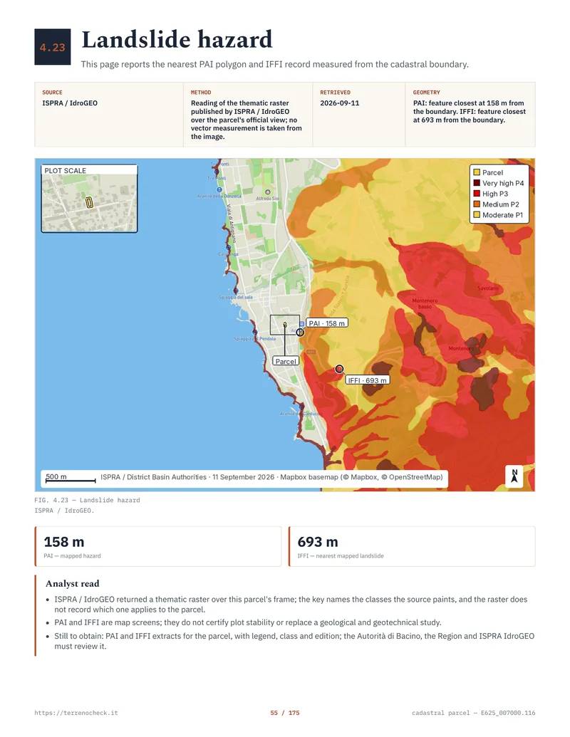
The nearest painted PAI landslide hazard is 158 m from the cadastral boundary and the nearest IFFI record 693 m. The reading assigns no class to the parcel: it is taken from a raster, which does not record which class applies to the plot.
Source and date
ISPRA / IdroGEO, national PAI landslide mosaic and IFFI inventory. Official view over the parcel’s frame, read on 11 September 2026.
Relation to the parcel
PAI landslide hazard: nearest feature 158 m from the cadastral boundary. IFFI: nearest feature 693 m from the same boundary.
What this means for the purchase
The two distances say where the source paints hazard, not that the ground is stable. A plot outside the hatching starts from a better position in the negotiation, but the design still rests on a geological report and investigation of the actual ground.
Before the deposit
Ask the Basin Authority for the PAI extract covering the sheet and parcel, with its legend, class and edition, and have a geologist define the investigation the proposed works require.
Limitation of the reading. This page looks at landslides only. Flood PAI is a separate layer, and in the same dossier, on page 75, its nearest feature sits about 2 m away. PAI and IFFI remain preliminary map screens: they do not certify plot stability and they do not replace a geological and geotechnical study.
Read the full guide for this check →