
Cadastral vs real boundaries in Italy
The line on an Italian cadastral map may identify the parcel without identifying the legal boundary. This guide explains what a buyer should check before a fence, a survey or a disputed strip becomes expensive.
Contents
- The catasto is a fiscal record, not a title register
- Why old Italian parcel maps go wrong
- What is probative when the line is disputed?
- Regolamento di confini is not rivendicazione
- Usucapione: when the wrong fence can become the boundary
- Tipo di frazionamento and tipo mappale do different jobs
- What a topografo actually does
- What boundary work costs
- What to require in the preliminary contract
- A buyer’s practical order of work
A fence and a cadastral line are evidence to compare, but neither determines the legal boundary on its own. Start with the title and its attachments, then reconcile them with cadastral history and a survey of the ground.
That is the single most misunderstood point in Italian land purchases: the catasto is not probative of ownership, and its map is not automatically probative of the boundary. Civil Code Article 950(3) lets the judge follow the cadastral maps only in the absence of other elements. The Corte Suprema di Cassazione has described the map as a residual, subsidiary source, not the starting answer.
This pre-purchase guide provides no legal opinion, title search or survey. TerrenoCheck does not verify ownership, boundary title, possession or a right to build. If a boundary matters to the price, the preliminary contract, the building footprint or a neighbour’s consent, put the question to an Italian notary and an appropriately qualified surveyor before paying a binding deposit. The Italian land-buying checklist is a useful document list to use alongside this one.
The catasto is a fiscal record, not a title register
The catasto terreni exists for parcel identification, classification and fiscal purposes. It records a comune catastale, foglio, particella, area and land information. It is not the registro immobiliare where transfers and mortgages are transcribed, and it is not a court judgment about who owns a strip of earth.
The map is issued by a public authority and has numbered lines, but its legal function is limited. The official Agenzia glossary describes the foglio di mappa catastale as a map of the catasto terreni, normally at a graphic scale of 1:2000 in urban centres, with 1:1000 or 1:4000 used more rarely. It shows roads, watercourses, parcel perimeters and building outlines. It does not say that every drawn perimeter is the final private-law boundary.
Article 950(1) of the Italian Civil Code says that, where the boundary between two funds is uncertain, either owner can ask the court to establish it. Subsection 2 admits any means of proof. Subsection 3 sends the judge to the boundary shown by the cadastral maps only in the absence of other elements. That last sentence is the part many listing descriptions leave out.
The same principle appears in recent case law. In Ordinance no. 11557 of 30 April 2024, the Second Civil Section stated that each party must put forward and prove suitable evidence for the exact line, while the judge chooses the more reliable elements and turns to cadastral results only as a last resort. Ordinance no. 20691 of 9 August 2018 likewise says that the boundary found on the ground is preferred to a mere cadastral-map result where the two differ.
The map still helps identify the parcel and connect old documents to current numbers. It is not the ownership deed.
Source: Agenzia delle Entrate, Administrative glossary, ‘Foglio di mappa catastale’
Pages from the delivered dossier
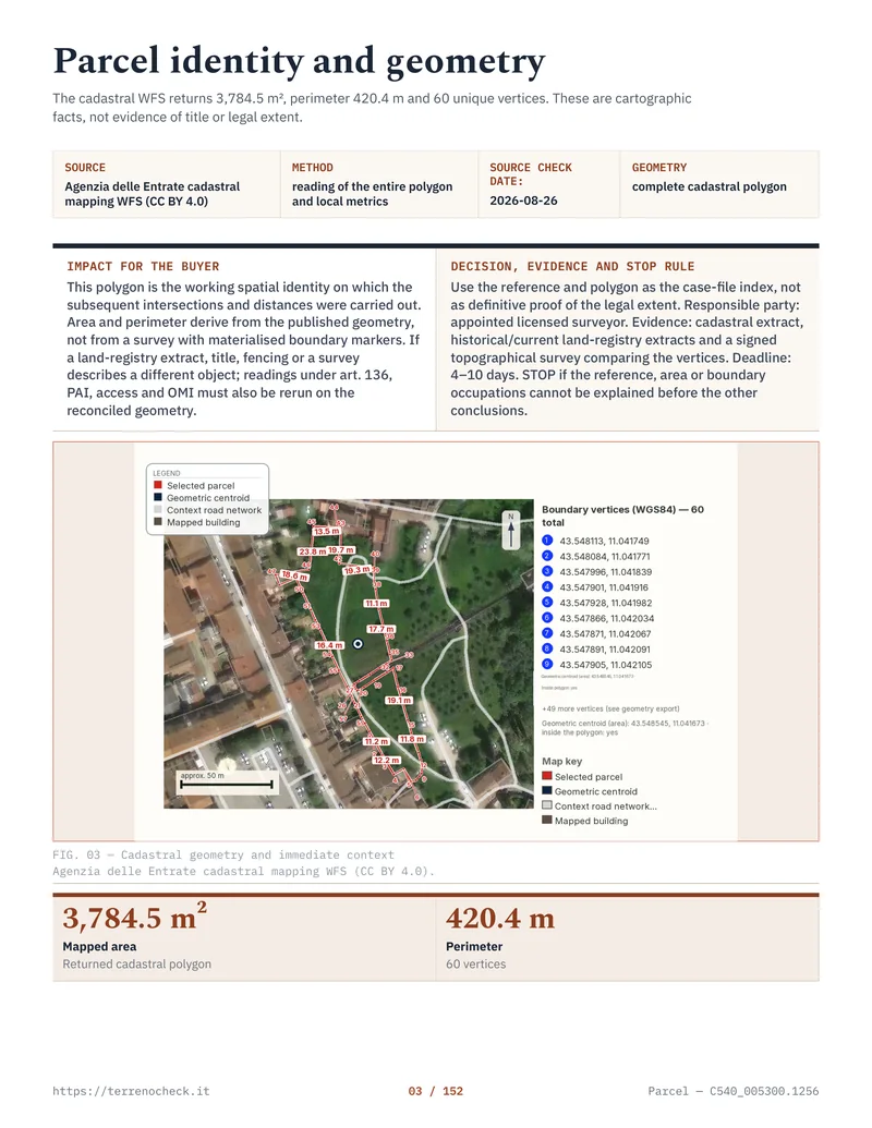 Open the full page
Why old Italian parcel maps go wrong
Many rural parcels begin with a catasto d’impianto, the original map created for the land-cadastre system. The modern buyer may now request the original sheet, a current digital map and an extract limited to live parcels. Agenzia’s 2025 service manual explicitly warns that current parcel numbers can differ from the numbers drawn on the Foglio Originale di Impianto.
That is the first source of confusion. A buyer sees an old number on an inheritance deed, a newer number on a visura, and a current number on the agent’s listing. They may all describe the same history, or one document may cover only part of it. The cadastral extract guide explains how to read the identifiers, but a current visura will not reconstruct every historical transfer for you.
The second problem is accumulated change. Parcels are split, merged, renumbered, transferred by inheritance and updated after buildings or roads appear. A tipo di frazionamento may create new identifiers while the physical fence remains where it was. The original map, later acts and present occupation can therefore disagree without any single document being a complete fraud.
There is no safe national “the map is accurate within X metres” rule to quote to a buyer. Accuracy depends on the sheet, the survey method used at the time, the map’s transformation history, identifiable control points and the terrain. Treat a metre-scale discrepancy as a real diligence issue, not as a harmless graphic tolerance. Nobody can tell you from a desk whether a particular line is legally wrong.
The 2025 Agenzia service lets an authenticated user obtain current map sheets and Fogli Originali di Impianto. It is described as free and permits up to 10 map files in one request. Those files support the technician’s comparison; they do not settle the boundary.
What is probative when the line is disputed?
Start with the deed that created or transferred the parcel. Read the atto di provenienza, its annexed plan and every referenced tipo di frazionamento. If the parcel came from a division, the division deed and its measured line may be more useful than the latest visura. If the seller’s land borders yours, obtain the neighbour’s title too. One title can describe a line by reference to the other parcel, an old road or a boundary marker.
Then look at possession. A wall, fence, hedge, ditch, cultivation line, terrace or gate can show how the land has been occupied. It can also show only what someone built. The court may weigh physical features, witness evidence, survey measurements, old plans, contracts, tax records and other documents. The relevant question is not “which line looks straight?” It is “which evidence most reliably identifies the land transferred and the ownership acquired?”
The buyer should ask for the seller’s full title chain, the affected neighbours’ titles and identifiers, original and current map sheets, subdivision plans and later updates. If possession is disputed, collect dated photographs, farm records and correspondence. The survey should mark the deed line, cadastral line and occupied line separately. A technician should not colour one line green and call it “the boundary” without saying where it came from.
Regolamento di confini is not rivendicazione
Italian buyers sometimes hear “boundary dispute” and assume every case is the same. It is not.
An azione di regolamento di confini under Civil Code Article 950 is used where the boundary between two neighbouring funds is uncertain. The claimant asks the court to establish the line. The issue is the location of the boundary, and both sides can rely on evidence. The judge is not required to accept the claimant’s line merely because the neighbour cannot produce a better map. The court selects the most reliable proof and may use a court-appointed technical expert.
An azione di rivendicazione under Civil Code Article 948 is different. The owner claims a specific thing from someone possessing or detaining it. The claimant’s job is to prove ownership and identify the thing being claimed. In a strip-of-land case, that means the owner must establish a title to the strip, or another legally recognised acquisition, and show that the occupied piece is that strip. A cadastral number alone is a poor substitute for that proof.
“The fence is 3 metres inside the map line” sounds like a survey observation. It does not tell you whether the deeds transferred the strip, possession changed ownership, or the dispute is simply an uncertain line under Article 950. The cadastral extract guide helps identify records, but it cannot choose the cause of action.
These routes overlap in real disputes, but they do not ask the claimant to prove the same thing. Have the notary or lawyer classify the problem before anyone promises a remedy.
| Buyer’s fact pattern | Relevant legal route | Evidence and number to understand |
|---|---|---|
| The line between two neighbouring funds is uncertain | Azione di regolamento di confini, Civil Code Article 950 | Any suitable proof; cadastral maps are residual under the final paragraph of Article 950; Cassation Ordinance no. 11557/2024 |
| A neighbour possesses an identifiable strip claimed as yours | Azione di rivendicazione, Civil Code Article 948 | The claimant must prove ownership and identify the thing claimed; a map number is not the title |
| A fence and exclusive occupation have lasted long enough to raise usucapion | Civil Code Article 1158 | 20 years for ordinary immovable-property usucapion, with possession proved by the person invoking it |
| A transcribed transfer title was acquired in good faith from a non-owner | Civil Code Article 1159 | 10 years from transcription, only if Article 1159’s title and good-faith conditions are satisfied |
Source: Normattiva, Civil Code Articles 948, 950, 1158 and 1159; Corte Suprema di Cassazione, Ordinance no. 11557/2024
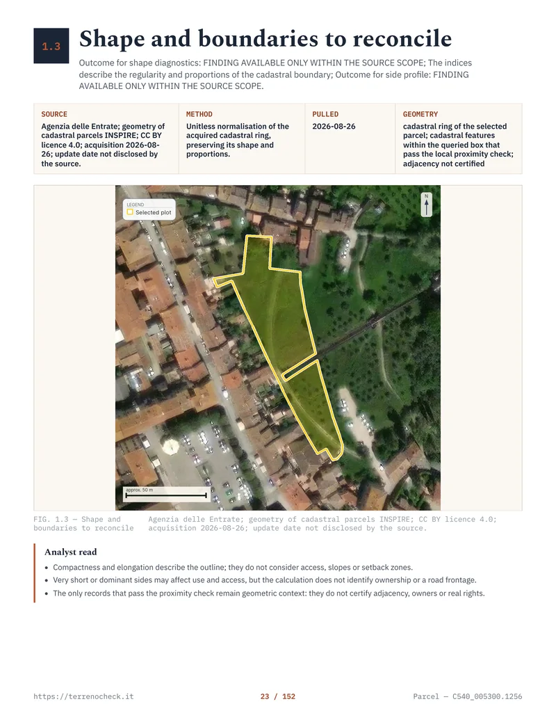 Open the full page
Usucapione: when the wrong fence can become the boundary
The fence is not magic. It is evidence of possession.
Under Article 1158 of the Civil Code, ownership of immovables and other real rights over immovables can be acquired by possession lasting 20 years. The possession has to be the kind the law recognises: public, peaceful and continuous in the relevant sense, exercised uti dominus, as an owner would, and sufficiently specific to the strip being claimed. The person who invokes usucapion carries the proof problem.
That is why a fence in the wrong place can become the legally relevant boundary after enough time. If a predecessor fenced a strip beyond the deed line, excluded the neighbour, cultivated it as part of the parcel and maintained it for more than 20 years, proved possession may have transferred that strip by usucapion. The cadastral map did not move the boundary. Possession may have changed the ownership position under the Civil Code.
The opposite facts matter just as much. A fence maintained by the neighbour, a gate used by both owners, a permissive arrangement, a missing section or a boundary that moved from year to year can undermine exclusivity or continuity. Aerial imagery can date a fence’s appearance, but cannot prove who possessed the strip or under what title. Ask for older photographs, farm records, witnesses and repair history.
There is a shorter variant. Article 1159 provides a 10-year usucapione abbreviata where the acquirer is in good faith, has a title suitable for transferring ownership even though the transferor was not the owner, and the title has been transcribed. The ten years run from transcription under the article’s conditions. A fence simply standing in the wrong place for ten years does not normally produce this result. Without the qualifying title and good faith, the ordinary 20-year rule is the relevant starting point.
Do not write “the fence has been there for 20 years” in a preliminary as if that were a completed title search. Say what is known, what is alleged and what must be proved. If the strip is material to access, building area or price, the seller should resolve the issue with the affected owner or the buyer should have a clear contractual exit.
Tipo di frazionamento and tipo mappale do different jobs
These are cadastral update documents, not boundary judgments.
A tipo di frazionamento divides a cadastral parcel into new parcels and supplies the geometric and identification basis for the change. It is the document you expect to see when a seller says that part of a field was sold, reserved, exchanged or transferred as a distinct piece. The deed may refer to its measured lines and the new parcel identifiers. If the seller says “the parcel was split years ago” but cannot produce the relevant type and title, the map history is incomplete.
A tipo mappale updates the land map for a building or building-related cadastral change. It can insert a building footprint, bring a rural building into the relevant urban-cadastre process or confirm a map situation in the cases covered by the Pregeo instructions. It does not certify that the building is authorised under planning law, and it does not prove that the wall was built on the ownership line.
The two can be combined. Agenzia’s Pregeo typology 18 describes a mixed update in which a parcel is divided and a building is inserted on one derived parcel. Ask which document was filed and for what purpose.
Use the planning-rights guide and the CDU guide for planning status. Keep that separate from the cadastral question. A cadastral update can make the database internally consistent while leaving a title dispute, an unlawful building or an occupied strip untouched.
- One parcel is divided into new parcelsTipo di frazionamento; reconcile the new identifiers with the deed and the measured line
- A building footprint or rural-building status must be represented or updatedTipo mappale; check the planning file separately
- A division and building insertion occur togetherMixed tipo di frazionamento + tipo mappale, Pregeo typology 18
- The parties disagree about who owns a stripNeither update settles that; compare titles, possession and the Civil Code Articles 948, 950, 1158 and 1159 routes
Source: Agenzia delle Entrate, Pregeo 10 technical guide; Agenzia del Territorio, Circular no. 3 of 16 October 2009, Pregeo typologies; Normattiva Civil Code
What a topografo actually does
A competent topografo, often a geometra or another qualified technical professional within the scope of their work, starts with documents. The GNSS receiver comes after the questions: Which points are described in the deed? Which parcel numbers are historical? Which corners, walls, roads or markers can be identified? Which neighbours’ titles must be compared?
In the field, the technician observes points with GNSS and may use a total station where satellite reception is poor. The instrument produces measured positions, not a legal conclusion. Agenzia’s 2024 Resolution no. 20/E describes Pregeo functions for processing receiver data, checking coordinates and distances, overlaying the survey on cadastral WMS cartography, and identifying a reference or permanent station in a public or private network.
The anchoring step is easy to misunderstand. GNSS gives observations in a reference system used by the equipment and processing workflow, while the cadastral map may have its own historical frame. The technician needs identifiable control or homologous points and a defensible adaptation. Pregeo’s guide describes orienting a survey to the map using pairs of corresponding georeferenced points. The deliverable should show its assumptions: reference system, anchor points, observation method, map and historical documents examined, discrepancies, and separate lines for deed, cadastral map and occupation. If the technician cannot explain the cadastral-frame connection, the overlay is not enough.
This is also where a cadastral “correction” can mislead a buyer. If the database line is wrong, an administrative correction may be possible in the right circumstances. If the neighbour owns the strip under a deed or usucapion, editing the map does not take it back. If the map is merely less accurate than the ground survey, forcing it to match the fence may create a neat record of the wrong assumption.
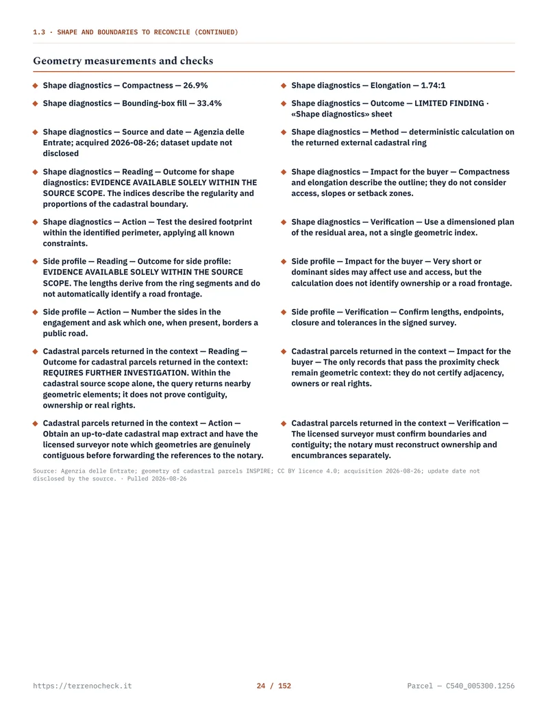 Open the full page
What boundary work costs
Agenzia’s 2025 map-sheet service is described as free for an authenticated user. Other cadastral or register documents may carry official charges. Those buy a record, not the survey.
There is no national public price list that tells a buyer what a boundary survey with GNSS, document reconstruction, neighbour-title review and written opinion must cost. The amount depends on the number of parcels, travel, terrain, missing deeds, archive work, the number of control points, whether a second visit is needed and whether the neighbour participates. I am not inserting a made-up euro range. Ask for a written quote that says whether it includes the visure, map sheets, original map, atti di provenienza, field survey, GNSS processing, plan, neighbour meeting, cadastral filing and VAT or professional contributions.
Litigation adds lawyer, court fees, technical expert work, private survey and time. A national “boundary dispute costs €X” figure would be fiction. The cost-of-buying-property guide explains the same budgeting discipline for the wider purchase.
What to require in the preliminary contract
If the boundary is unclear, the preliminary should not pretend it is clear. Ask the notary or lawyer to draft a condition that matches the actual risk. The preliminary-contract guide covers the wider function of the preliminare; here the clause needs to be specific to the parcels and the disputed line.
Require the seller to deliver the title chain, current and original map material, subdivision documents and available titles for affected neighbours. Name the comune catastale, section if any, foglio, current particella numbers and historical numbers. Attach the plan under discussion.
If a survey is still needed, state who appoints the independent technician, who pays, what documents the survey must examine, how the three lines will be shown, and the deadline. The seller should obtain access to adjoining land and provide prior survey files. If the boundary must be agreed with a neighbour, the completion condition should require a signed instrument in the proper form, with the line described and any necessary transcription handled before the buyer relies on it.
The clause should say what happens if the survey finds a material discrepancy: withdrawal, price adjustment, seller resolution or a deposit arrangement agreed with the notary may be possible. The correct mechanism depends on the transaction. Do not copy a generic “subject to survey” sentence.
If a boundary is central to a proposed building, connect the planning and cadastral work. The CDU guide and planning documents answer land-use questions; the survey answers geometry; the deed and title review answer ownership.
A buyer’s practical order of work
Start with the parcel identity in the advert and check it against the seller’s deed. Obtain current and historical cadastral material, the original map where available, and the property-register searches the notary considers necessary. Mark the fence, wall, road, gate and buildings on a working plan.
Then commission the survey. Ask where the deed line, cadastral representation and present occupation lie, what supports each, and what remains uncertain. If documents are missing, a neighbour refuses access, the line affects a building or a title dispute is active, the price and preliminary must acknowledge the problem.
Sources
- Normattiva, Civil Code, Royal Decree 16 March 1942, no. 262
- Corte Suprema di Cassazione, Civil Section, Ordinance no. 11557 of 30 April 2024
- Corte Suprema di Cassazione, Civil Section, Ordinance no. 20691 of 9 August 2018
- Agenzia delle Entrate, Administrative glossary, cadastral map sheet
- Agenzia delle Entrate, Consultazione dei fogli di mappa catastale, version 30 September 2025
- Agenzia delle Entrate, Resolution no. 20/E of 18 April 2024, updated Pregeo
- Agenzia delle Entrate, Pregeo 10 technical guide
- Agenzia del Territorio, Circular no. 3 of 16 October 2009, Pregeo typologies
- Gazzetta Ufficiale, Civil Code Article 948, action to recover a specific thing
- Gazzetta Ufficiale, Civil Code Article 950, boundary-determination action
- Gazzetta Ufficiale, Civil Code Article 1158, twenty-year usucapion
- Gazzetta Ufficiale, Civil Code Article 1159, ten-year usucapion